
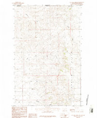
1984 Map of O'Juel Lake
USGS Topo · Published 1984About this map
The Opheim Hills and Dahl Hills dominate this portion of Valley County, Montana, representing a characteristic northern plains landscape of high, rolling terrain cut by an intricate network of drainages. The hydrology of the area is defined by seasonal and perennial waters like the namesake O'Juel Lake and the Middle Fork Porcupine Creek. A notable human imprint in this otherwise sparsely settled landscape is the Furlong Landing Strip located in the northwest, suggesting the importance of aviation for reaching these more isolated sections of the plains in the 1980s. Local history is anchored by specific landmarks such as Dashers Spring and the curiously named Pikes Peak, which provide fixed reference points in a region otherwise defined by numerous branching coulees, including Coyote Coulee and Deep Coulee.
Find a feature on this map
16 named features on this map. Tap any name to fly to it.
Don’t see what you’re looking for? This feature index may not catch every label — zoom into the map to look around manually.
Map Details
Editions of this 1984 O'Juel Lake Map
This is the sole edition of this map. No revisions or reprints were ever made.
Other maps of this area

1919 · Boundary
USGS Topo · 1:125,000

1954 · Glasgow
USGS Topo · 1:250,000

1957 · Glasgow
USGS Topo · 1:250,000

1958 · Glasgow
USGS Topo · 1:250,000

1973 · Baylor
USGS Topo · 1:24,000

1973 · Opheim
USGS Topo · 1:24,000

1973 · Roanwood
USGS Topo · 1:24,000

1984 · Opheim
USGS Topo · 1:100,000

1984 · Dodge Reservoir
USGS Topo · 1:24,000
1984 · Coal Mine Creek East
USGS Topo · 1:24,000