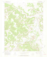
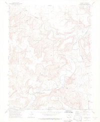
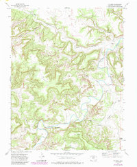
1972 Map of O V Mesa
USGS Topo · Published 1976About this map
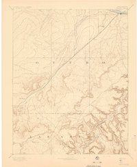
Purgatoire River meanders through a labyrinth of deep canyons and mesas in this 1970s topographical record. The landscape is defined by its isolation and the necessity of water management, evidenced by features like the Pamena Windmill and Cistern Windmill dotting the arid terrain. Settlement in this corner of Las Animas County is sparse, centering on the Rourke Ranch located near the riverbank. Historical evidence of habitation persists through labeled Ruins in the northern Bent Canyon and a lone Cem tucked into a canyon fold. The geography is characterized by prominent elevations such as O V Mesa and the Black Hills, while access is limited to a network of Jeep Trails and the historic Sugar Trail, suggesting a rugged ranching economy and a difficult environment for travel.
Find a feature on this map
22 named features on this map. Tap any name to fly to it.
Don’t see what you’re looking for? This feature index may not catch every label — zoom into the map to look around manually.
Map Details
Editions of this 1972 O V Mesa Map
3 editions found
Other maps of this area

1891 · Timpas
USGS Topo · 1:125,000

1891 · Mesa De Maya
USGS Topo · 1:125,000
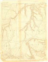
1893 · Mesa de Maya
USGS Topo · 1:125,000
1894 · Timpas
USGS Topo · 1:125,000

1955 · La Junta
USGS Topo · 1:250,000

1958 · La Junta
USGS Topo · 1:250,000

1968 · La Junta
USGS Topo · 1:250,000
1972 · Johnson Canyon
USGS Topo · 1:24,000
1972 · Doss Canyon North
USGS Topo · 1:24,000
1972 · Plum Canyon
USGS Topo · 1:24,000