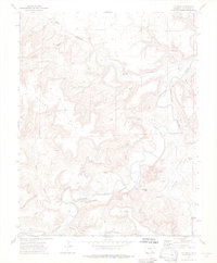
1972 Map of O V Mesa
USGS Topo · Published 1976About this map
Purgatoire River carves a deep, winding course through this Las Animas County landscape, where the high plateau of O V Mesa overlooks a complex system of drainages. The map records a sparsely populated ranching territory characterized by early settlements and isolated landmarks like Rourke Ranch and Bruno. Human presence is marked by scattered water sources essential for survival in this arid environment, including the Cistern Windmill, Mesa Windmill, and Pameña Windmill.
Find a feature on this map
27 named features on this map. Tap any name to fly to it.
Don’t see what you’re looking for? This feature index may not catch every label — zoom into the map to look around manually.
Map Details
Editions of this 1972 O V Mesa Map
3 editions found
Other maps of this area

1891 · Timpas
USGS Topo · 1:125,000

1891 · Mesa De Maya
USGS Topo · 1:125,000

1893 · Mesa de Maya
USGS Topo · 1:125,000

1894 · Timpas
USGS Topo · 1:125,000

1955 · La Junta
USGS Topo · 1:250,000

1958 · La Junta
USGS Topo · 1:250,000

1968 · La Junta
USGS Topo · 1:250,000

1972 · Johnson Canyon
USGS Topo · 1:24,000

1972 · Doss Canyon North
USGS Topo · 1:24,000

1972 · Plum Canyon
USGS Topo · 1:24,000