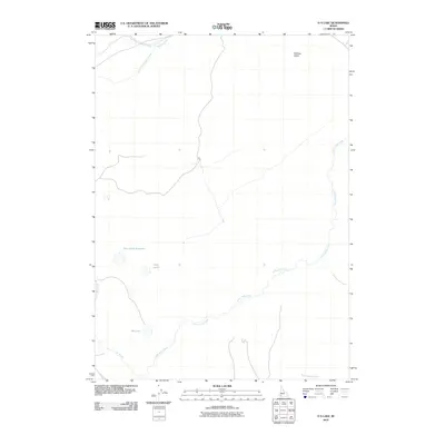
2010 Map of O X Lake
USGS Topo · Published 2010About this map
Little Jacks Creek carves a winding path through this high desert region of Owyhee County, serving as a primary drainage for the surrounding plateaus. The landscape is defined by its seasonal water sources and catchment basins, most notably the Twin Lakes Reservoir and the adjacent Twin Lakes. These features, along with Ox Lake, represent critical water management points in an otherwise arid environment. The northern portion of the map is dominated by the headwaters of Shoofly Creek, including its West Fork and East Fork tributaries. The presence of Halfway Gulch and Rattlesnake Creek further illustrates the complex erosional patterns that characterize this part of Idaho. This 2010 survey by the U.S. Geological Survey details a landscape where primitive roads and seasonal creek beds dictate movement across the terrain.
Find a feature on this map
10 named features on this map. Tap any name to fly to it.
Don’t see what you’re looking for? This feature index may not catch every label — zoom into the map to look around manually.
Map Details
Editions of this 2010 O X Lake Map
This is the sole edition of this map. No revisions or reprints were ever made.
Other maps of this area

1947 · Grand View
USGS Topo · 1:62,500

1947 · Chalk Hills
USGS Topo · 1:24,000

1947 · Perjue Canyon
USGS Topo · 1:24,000

1948 · Perjue Canyon
USGS Topo · 1:24,000
1948 · Chalk Hills
USGS Topo · 1:24,000

1955 · Jordan Valley
USGS Topo · 1:250,000

1957 · Jordan Valley
USGS Topo · 1:250,000

1958 · Jordan Valley
USGS Topo · 1:250,000
1972 · Hill Pasture
USGS Topo · 1:24,000
1972 · Rough Mountain
USGS Topo · 1:24,000