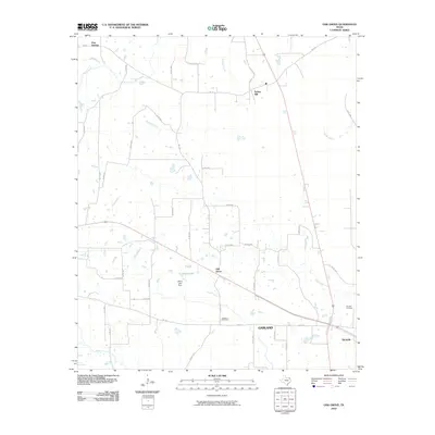
2010 Map of Oak Grove
USGS Topo · Published 2010About this map
The settlement of Oak Grove sits at the center of this 2010 survey, anchoring a network of farm-to-market roads and county lanes in Bowie County. The landscape is defined by its water systems, notably Elkins Lake with the engineered Elkins Lake Dam and the winding course of Hooks Bayou in the northeast. This area of East Texas exhibits a dispersed rural residential pattern, with small communities like Spring Hill and Pine Springs connected by routes such as FM 114 and FM 1326.
Find a feature on this map
44 named features on this map. Tap any name to fly to it.
Don’t see what you’re looking for? This feature index may not catch every label — zoom into the map to look around manually.
Map Details
Editions of this 2010 Oak Grove Map
This is the sole edition of this map. No revisions or reprints were ever made.
Other maps of this area

1930 · Bassett
USGS Topo · 1:62,500

1950 · De Kalb NW
USGS Topo · 1:24,000

1950 · Tom
USGS Topo · 1:24,000

1950 · De Kalb
USGS Topo · 1:24,000

1950 · Oak Grove
USGS Topo · 1:24,000

1951 · De Kalb
USGS Topo · 1:24,000

1951 · English
USGS Topo · 1:24,000

1951 · De Kalb NW
USGS Topo · 1:24,000

1951 · Tom
USGS Topo · 1:24,000

1951 · Oak Grove
USGS Topo · 1:24,000