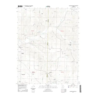
2015 Map of Oak Grove Heights
USGS Topo · Published 2015About this map
Oak Grove Heights and the surrounding rural communities of Palmetto and Henderson are defined by the winding course of the James River as it carves through southwestern Missouri. This terrain is marked by significant topographical shifts, featuring deep drainages such as Millan Hollow and White Oak Hollow. The area maintains its agricultural and residential character, centered around historically established family and community locations like Panther Valley Cemetery and Wilkerson Cemetery. Transportation and infrastructure are vital to the landscape, evidenced by the Steel Bridge over the river and the presence of Cuinche Airport to the north. Smaller tributaries, including Sayers Creek and Norman Br, weave through the countryside, illustrating the complex drainage system that feeds into the James River. The map also records the boundary between Greene and Webster counties, highlighting how local governance intersects with the natural geography of the Ozarks.
Find a feature on this map
104 named features on this map. Tap any name to fly to it.
Don’t see what you’re looking for? This feature index may not catch every label — zoom into the map to look around manually.
Map Details
Editions of this 2015 Oak Grove Heights Map
This is the sole edition of this map. No revisions or reprints were ever made.
Other maps of this area

1884 · Springfield
USGS Topo · 1:125,000

1886 · Springfield
USGS Topo · 1:125,000

1937 · Galloway
USGS Topo · 1:24,000

1937 · Ozark
USGS Topo · 1:48,000

1939 · Fordland
USGS Topo · 1:62,500

1942 · Fordland
USGS Topo · 1:62,500

1943 · Ozark
USGS Topo · 1:62,500

1945 · Ozark
USGS Topo · 1:62,500

1946 · Bassville
USGS Topo · 1:24,000

1946 · Niangua
USGS Topo · 1:62,500