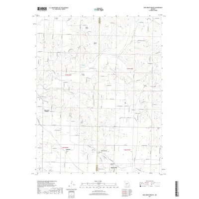
2017 Map of Oak Grove Heights
USGS Topo · Published 2017About this map
The James River snakes through the rolling terrain of Greene and Webster Counties, anchoring a landscape defined by small communities and rural family farmsteads in the late 2010s. The settlement of Oak Grove Heights and the crossroads of Palmetto serve as primary landmarks in the western portion of the map, while Rogersville sits along the southern boundary near White Oak Hollow. For those researching local lineages, the map identifies several burial sites including Palmetto Cem, Henderson Cem, and Wilkerson Cem, often found near old farm roads and drainage basins.
Find a feature on this map
122 named features on this map. Tap any name to fly to it.
Don’t see what you’re looking for? This feature index may not catch every label — zoom into the map to look around manually.
Map Details
Editions of this 2017 Oak Grove Heights Map
This is the sole edition of this map. No revisions or reprints were ever made.
Other maps of this area

1884 · Springfield
USGS Topo · 1:125,000

1886 · Springfield
USGS Topo · 1:125,000

1937 · Galloway
USGS Topo · 1:24,000

1937 · Ozark
USGS Topo · 1:48,000

1939 · Fordland
USGS Topo · 1:62,500

1942 · Fordland
USGS Topo · 1:62,500

1943 · Ozark
USGS Topo · 1:62,500

1945 · Ozark
USGS Topo · 1:62,500

1946 · Bassville
USGS Topo · 1:24,000

1946 · Niangua
USGS Topo · 1:62,500