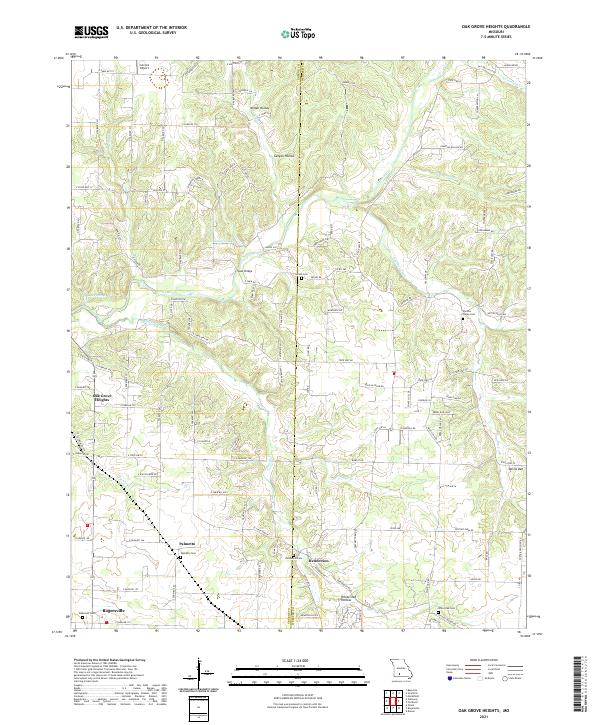
2021 Map of Oak Grove Heights
USGS Topo · Published 2021About this map
Oak Grove Heights and the surrounding rural communities of Palmetto and Henderson are defined by the winding course of the James River as it cuts through the Greene and Webster county line. This upland landscape is marked by a high density of small family and community burial grounds, including Shiloh Cem, Palmetto Cem, and the White Oak Cem, which provide significant points of interest for genealogical research. The local topography is carved into distinct hollows like Millan Hollow and White Oak Hollow, with the Steel Bridge and Cuinche Airport serving as notable landmarks in the transition between the rolling hills and the developing fringes of Rogersville. The map captures a detailed network of farm roads and state highways, such as E State Hwy AD and E State Hwy D, which delineate the modern agricultural and residential property boundaries across the Ozark plateau.
Find a feature on this map
81 named features on this map. Tap any name to fly to it.
Don’t see what you’re looking for? This feature index may not catch every label — zoom into the map to look around manually.
Map Details
Editions of this 2021 Oak Grove Heights Map
This is the sole edition of this map. No revisions or reprints were ever made.
Other maps of this area

1884 · Springfield
USGS Topo · 1:125,000

1886 · Springfield
USGS Topo · 1:125,000

1937 · Galloway
USGS Topo · 1:24,000

1937 · Ozark
USGS Topo · 1:48,000

1939 · Fordland
USGS Topo · 1:62,500

1942 · Fordland
USGS Topo · 1:62,500

1943 · Ozark
USGS Topo · 1:62,500

1945 · Ozark
USGS Topo · 1:62,500

1946 · Bassville
USGS Topo · 1:24,000

1946 · Niangua
USGS Topo · 1:62,500