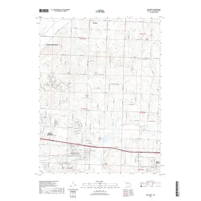
2017 Map of Oak Grove
USGS Topo · Published 2017About this map
Grain Valley and the eastern edge of Blue Springs anchor this landscape during a period of modern expansion in Jackson County. The terrain is defined by the winding course of Sni-A-Bar Creek, which flows past landmarks like Monkey Mountain and the Grain Valley Cemetery. This area serves as a transition between the suburban reach of Independence and more rural stretches, marked by small private airfields like Washburn Farm Airport and East Kansas City Airport. Genealogy researchers will find significant value in the numerous burial grounds documented here, including Oakland Cemetery and the isolated Mecklin Cemetery near Seminary Creek. The Kansas City Southern rail line cuts through the southern portion of the map, illustrating the enduring importance of transit corridors in this part of Missouri.
Find a feature on this map
169 named features on this map. Tap any name to fly to it.
Don’t see what you’re looking for? This feature index may not catch every label — zoom into the map to look around manually.
Map Details
Editions of this 2017 Oak Grove Map
This is the sole edition of this map. No revisions or reprints were ever made.
Other maps of this area

1887 · Harrisonville
USGS Topo · 1:125,000

1892 · Harrisonville
USGS Topo · 1:125,000

1894 · Harrisonville
USGS Topo · 1:125,000

1894 · Independence
USGS Topo · 1:125,000

1933 · Blue Springs
USGS Topo · 1:24,000

1934 · Oak Grove
USGS Topo · 1:24,000

1934 · Woods Chapel
USGS Topo · 1:24,000

1935 · Buckner
USGS Topo · 1:24,000

1935 · Missouri City
USGS Topo · 1:24,000

1935 · Tarsney
USGS Topo · 1:24,000