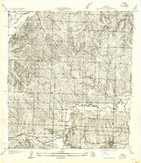
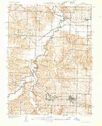
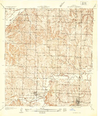
1934 Map of Oak Grove
USGS Topo · Published 1955About this map
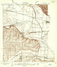
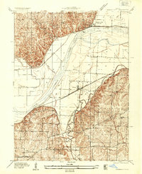
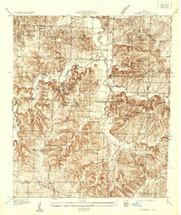
Sni A Bar Creek meanders across this eastern Jackson County landscape, anchoring a rural territory defined by early mid-century transport and education. This 1934 survey, published as an advance sheet, details the corridor between Grain Valley and Oak Grove during an era when the Chicago and Alton railroad and the Jefferson Highway served as the primary arteries for local commerce. The map reveals a high density of rural schoolhouses, including Sunny Nook Sch, Glenside Sch, and Pink Hill Sch, reflecting a distributed community structure typical of Missouri’s agricultural heartland before mid-century school consolidations. Smaller waterways like Blue Branch and Shirley Branch feed into the larger creek system, illustrating the natural drainage patterns that dictated early road placement and property lines.
Find a feature on this map
14 named features on this map. Tap any name to fly to it.
Don’t see what you’re looking for? This feature index may not catch every label — zoom into the map to look around manually.
Map Details
Editions of this 1934 Oak Grove Map
2 editions found
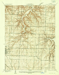
Other maps of this area

1887 · Harrisonville
USGS Topo · 1:125,000

1892 · Harrisonville
USGS Topo · 1:125,000

1894 · Harrisonville
USGS Topo · 1:125,000

1894 · Independence
USGS Topo · 1:125,000
1933 · Blue Springs
USGS Topo · 1:24,000
1934 · Oak Grove
USGS Topo · 1:24,000
1934 · Woods Chapel
USGS Topo · 1:24,000
1935 · Buckner
USGS Topo · 1:24,000
1935 · Missouri City
USGS Topo · 1:24,000
1935 · Tarsney
USGS Topo · 1:24,000