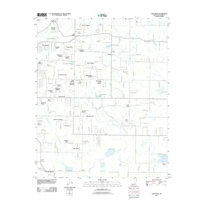
2011 Map of Oak Grove
USGS Topo · Published 2011About this map
Old Austin and its surrounding communities reflect a landscape defined by ancestral ties and the meandering waters of Wattensaw Bayou. This Arkansas terrain is notable for its numerous burial grounds, including the Camp Nelson Confederate Cemetery and several family-named locations such as the Monk Cemetery and Russ Cemetery. The map illustrates a period of significant suburban expansion, evidenced by a dense network of residential additions like Vise Addition, Trailwood Addition, and Shadow Oaks Addition which have begun to fill the spaces between established hamlets.
Find a feature on this map
98 named features on this map. Tap any name to fly to it.
Don’t see what you’re looking for? This feature index may not catch every label — zoom into the map to look around manually.
Map Details
Editions of this 2011 Oak Grove Map
This is the sole edition of this map. No revisions or reprints were ever made.
Other maps of this area

1891 · Little Rock
USGS Topo · 1:125,000

1893 · Little Rock
USGS Topo · 1:125,000

1940 · Lonoke
USGS Topo · 1:62,500

1941 · Cabot
USGS Topo · 1:31,680

1943 · Jacksonville
USGS Topo · 1:31,680

1948 · Helena
USGS Topo · 1:250,000

1949 · Lonoke
USGS Topo · 1:62,500

1950 · Helena
USGS Topo · 1:250,000

1950 · Lonoke
USGS Topo · 1:62,500

1953 · Memphis
USGS Topo · 1:250,000