
1950 Map of Lonoke
USGS Topo · Published 1952About this map
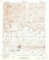
Lonoke serves as the central hub of this mid-century landscape, positioned along the Chicago Rock Island and Pacific railroad corridor. The area is defined by a dense network of rural infrastructure, including numerous family-named cemeteries and community churches such as Smyrna Ch and New Hope Ch. A prominent landmark is the State Fish Hatchery just south of the main town site, illustrating the early development of state-managed resources.
Find a feature on this map
77 named features on this map. Tap any name to fly to it.
Don’t see what you’re looking for? This feature index may not catch every label — zoom into the map to look around manually.
Map Details
Editions of this 1950 Lonoke Map
2 editions found
Other maps of this area

1891 · Little Rock
USGS Topo · 1:125,000

1893 · Little Rock
USGS Topo · 1:125,000

1932 · Kensett
USGS Topo · 1:62,500

1935 · Kensett
USGS Topo · 1:62,500

1935 · Hazen
USGS Topo · 1:62,500

1937 · Stuttgart
USGS Topo · 1:62,500

1937 · England
USGS Topo · 1:48,000

1939 · Stuttgart
USGS Topo · 1:62,500

1940 · Lonoke
USGS Topo · 1:62,500

1941 · Hazen
USGS Topo · 1:62,500