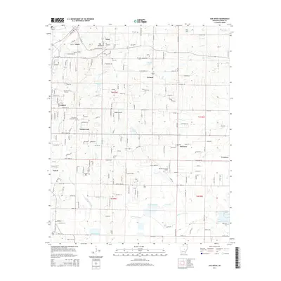
2014 Map of Oak Grove
USGS Topo · Published 2014About this map
Old Austin and Old Austin Cem serve as focal points for local history in this central Arkansas landscape, where the communities of Ward, Austin, and Sylvania bridge the transition from upland terrain into the Arkansas Delta. The area is notable for its numerous burial grounds, including the Camp Nelson Confederate Cem and the Sylvania Cem, which underscore the region's deep-rooted settlement patterns. Waterways like the meandering Wattensaw Bayou and Locust Cr flow through the southern half of the sheet, shaping the agricultural layout and property lines. Aviation interest is represented by the Ralph Fulmer Field Airport, while the growth of residential areas around Cabot is evident in developments like Whisperwood. The map provides a detailed view of the rural-to-suburban landscape at a time when traditional landmarks like Bell Hill and Smith Mtn remained distinct amidst modern road networks.
Find a feature on this map
197 named features on this map. Tap any name to fly to it.
Don’t see what you’re looking for? This feature index may not catch every label — zoom into the map to look around manually.
Map Details
Editions of this 2014 Oak Grove Map
This is the sole edition of this map. No revisions or reprints were ever made.
Other maps of this area

1891 · Little Rock
USGS Topo · 1:125,000

1893 · Little Rock
USGS Topo · 1:125,000

1940 · Lonoke
USGS Topo · 1:62,500

1941 · Cabot
USGS Topo · 1:31,680

1943 · Jacksonville
USGS Topo · 1:31,680

1948 · Helena
USGS Topo · 1:250,000

1949 · Lonoke
USGS Topo · 1:62,500

1950 · Helena
USGS Topo · 1:250,000

1950 · Lonoke
USGS Topo · 1:62,500

1953 · Memphis
USGS Topo · 1:250,000