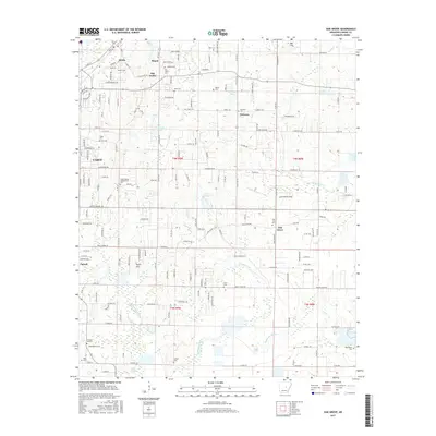
2017 Map of Oak Grove
USGS Topo · Published 2017About this map
The historical settlements of Austin, Old Austin, and Ward anchor the northwestern corner of this Arkansas landscape, where the headwaters of Hudson Branch and Mill Creek begin their descent toward the lowlands. The area is dense with genealogical landmarks, particularly the Camp Nelson Confederate Cem and various family-named burial grounds like Monk Cem and Glover Cem. The terrain transitions from the elevations of Smith Mountain and Bell Hill toward the hydrologic network of the southeast, dominated by the winding path of Wattensaw Bayou and its tributaries such as Locust Creek. This 2017 survey reflects the suburban growth of Cabot pressing against traditional rural crossroads like Sylvania and Oak Grove, offering a detailed view of the evolving parcel boundaries and road networks that define modern Lonoke County.
Find a feature on this map
181 named features on this map. Tap any name to fly to it.
Don’t see what you’re looking for? This feature index may not catch every label — zoom into the map to look around manually.
Map Details
Editions of this 2017 Oak Grove Map
This is the sole edition of this map. No revisions or reprints were ever made.
Other maps of this area

1891 · Little Rock
USGS Topo · 1:125,000

1893 · Little Rock
USGS Topo · 1:125,000

1940 · Lonoke
USGS Topo · 1:62,500

1941 · Cabot
USGS Topo · 1:31,680

1943 · Jacksonville
USGS Topo · 1:31,680

1948 · Helena
USGS Topo · 1:250,000

1949 · Lonoke
USGS Topo · 1:62,500

1950 · Helena
USGS Topo · 1:250,000

1950 · Lonoke
USGS Topo · 1:62,500

1953 · Memphis
USGS Topo · 1:250,000