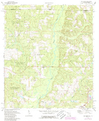
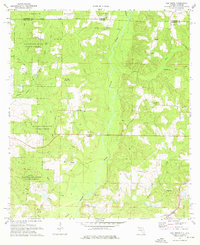
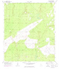
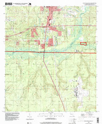
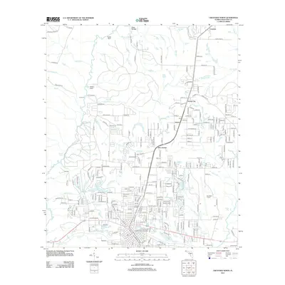
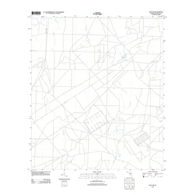
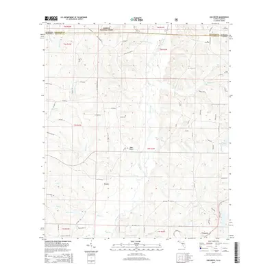
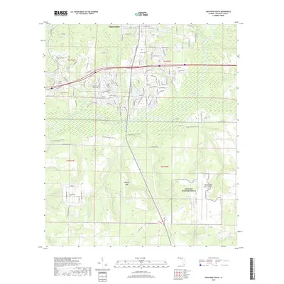
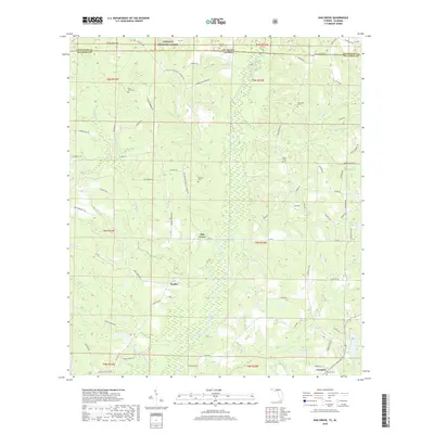
1973 Map of Oak Grove
USGS Topo · Published 1987About this map
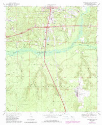
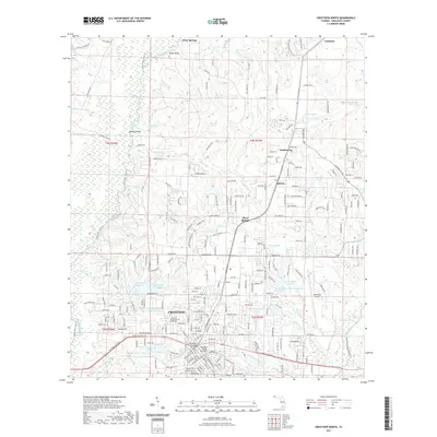
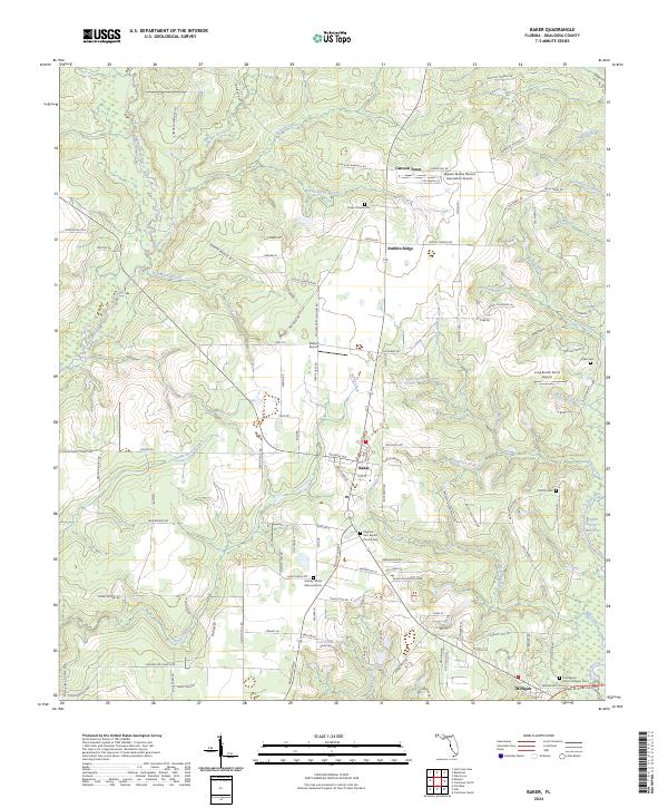
The Yellow River bisects this landscape of the Florida-Alabama borderlands, carving a wide valley through the dense timberlands of the Conecuh National Forest and Blackwater River State Forest. The settlement at Oak Grove serves as a central point in a territory defined by its creek networks, including Big Creek and the southern-flowing Murder Creek. The map provides significant genealogical value for Okaloosa County, documenting a series of remote burial grounds such as Peaden Cem, Old Ebenezer Cem, and Newell Cem that are tucked away in the forest or near small country churches. Transportation through the area is anchored by the CSX rail line, which follows the corridor near Campion Ch, reflecting the region’s long-standing connection to the timber and river-based economies of the Panhandle.
Find a feature on this map
37 named features on this map. Tap any name to fly to it.
Don’t see what you’re looking for? This feature index may not catch every label — zoom into the map to look around manually.
Map Details
Editions of this 1973 Oak Grove Map
2 editions found
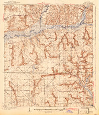
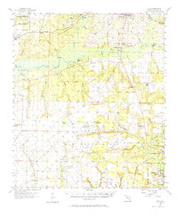
Historical Maps of Peaden Through Time
58 maps found

1934 Holt
Okaloosa County, FL
1937 Holt
Okaloosa County, FL
1956 Holt
Okaloosa County, FL
1970 Holt SW
Okaloosa County, FL
1973 Baker
Okaloosa County, FL
1973 Blackman
Okaloosa County, FL
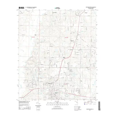
1973 Crestview North
Okaloosa County, FL
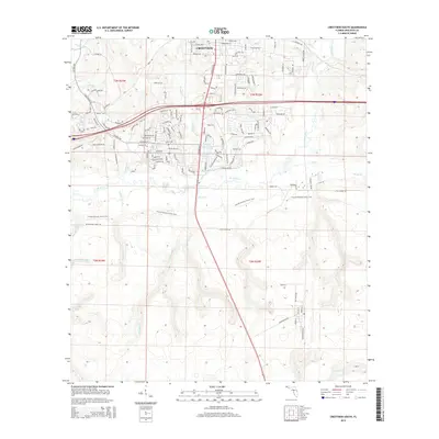
1973 Crestview South
Okaloosa County, FL
1973 Dorcas
Okaloosa County, FL
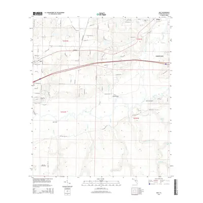
1973 Holt
Okaloosa County, FL
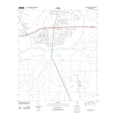
1973 Oak Grove
Okaloosa County, FL
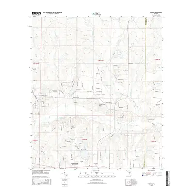
1973 Spencer Flats
Okaloosa County, FL
1994 Crestview South
Okaloosa County, FL
2011 Blackman
Okaloosa County, FL
2011 Oak Grove
Okaloosa County, FL
2012 Baker
Okaloosa County, FL
2012 Crestview North
Okaloosa County, FL
2012 Crestview South
Okaloosa County, FL
2012 Dorcas
Okaloosa County, FL
2012 Holt
Okaloosa County, FL
2012 Holt SW
Okaloosa County, FL
2012 Spencer Flats
Okaloosa County, FL
2015 Baker
Okaloosa County, FL
2015 Blackman
Okaloosa County, FL
2015 Crestview North
Okaloosa County, FL
2015 Crestview South
Okaloosa County, FL
2015 Dorcas
Okaloosa County, FL
2015 Holt
Okaloosa County, FL

2015 Holt SW
Okaloosa County, FL
2015 Oak Grove
Okaloosa County, FL

2015 Spencer Flats
Okaloosa County, FL
2018 Baker
Okaloosa County, FL
2018 Blackman
Okaloosa County, FL
2018 Crestview North
Okaloosa County, FL
2018 Crestview South
Okaloosa County, FL
2018 Dorcas
Okaloosa County, FL
2018 Holt
Okaloosa County, FL
2018 Holt SW
Okaloosa County, FL
2018 Oak Grove
Okaloosa County, FL
2018 Spencer Flats
Okaloosa County, FL
2021 Baker
Okaloosa County, FL
2021 Blackman
Okaloosa County, FL
2021 Crestview North
Okaloosa County, FL

2021 Crestview South
Okaloosa County, FL
2021 Dorcas
Okaloosa County, FL
2021 Holt
Okaloosa County, FL

2021 Holt SW
Okaloosa County, FL

2021 Oak Grove
Okaloosa County, FL

2021 Spencer Flats
Okaloosa County, FL
2024 Baker
Okaloosa County, FL
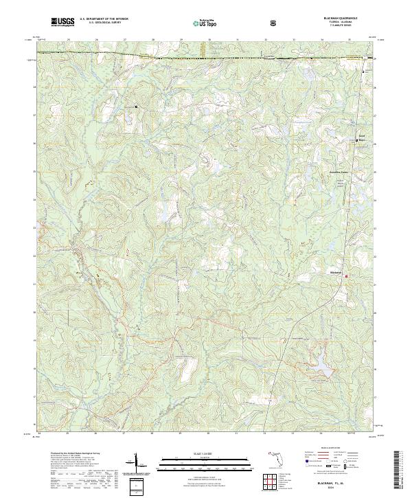
2024 Blackman
Okaloosa County, FL
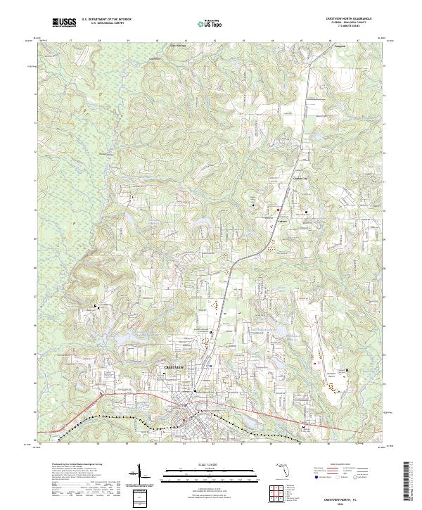
2024 Crestview North
Okaloosa County, FL
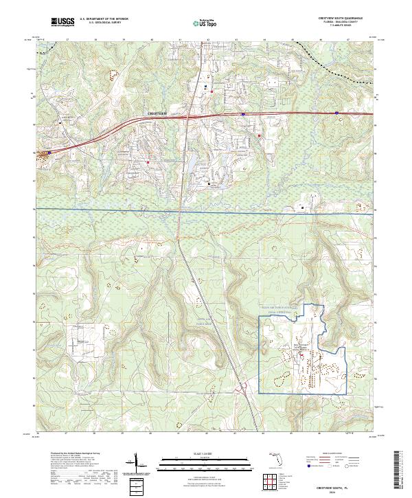
2024 Crestview South
Okaloosa County, FL
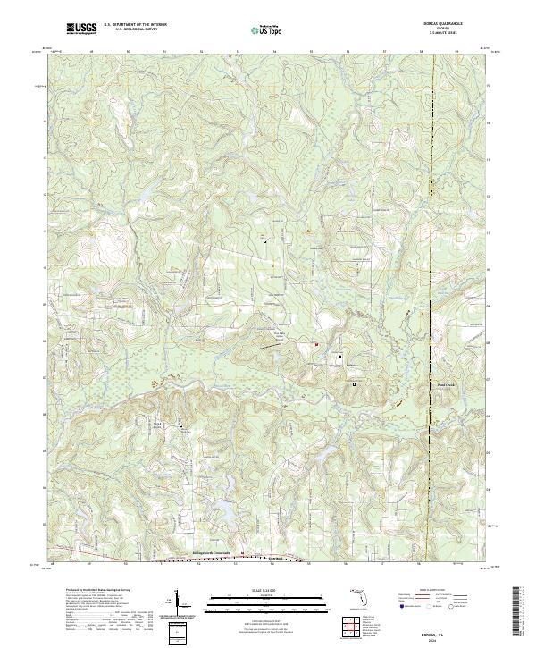
2024 Dorcas
Okaloosa County, FL
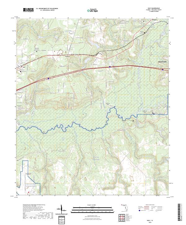
2024 Holt
Okaloosa County, FL
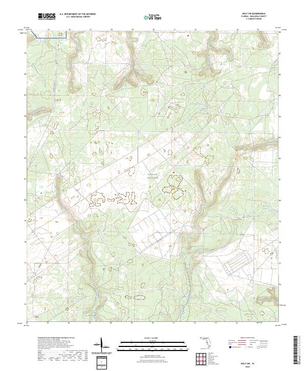
2024 Holt SW
Okaloosa County, FL
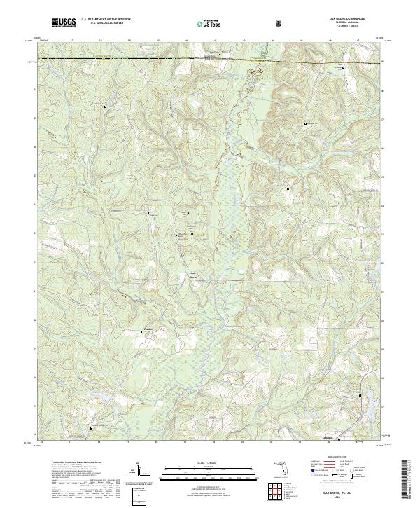
2024 Oak Grove
Okaloosa County, FL
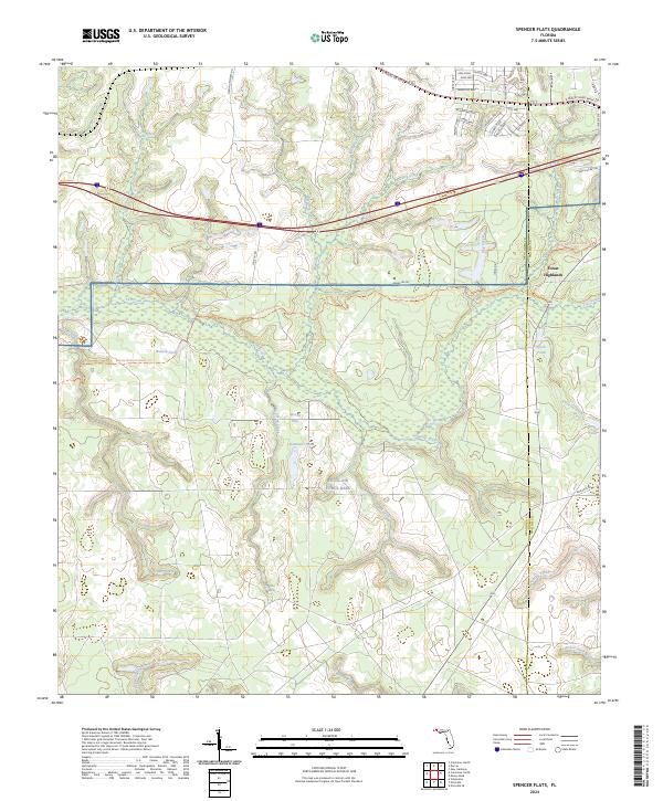
2024 Spencer Flats
Okaloosa County, FL