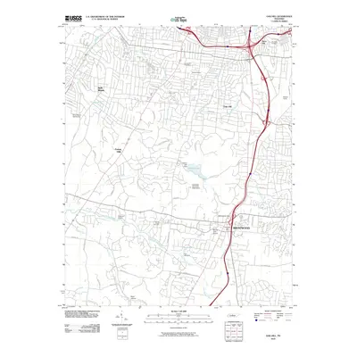
2010 Map of Oak Hill
USGS Topo · Published 2010About this map
Radnor Lake and its corresponding Radnor Lake Dam serve as a central geographic anchor for this suburban landscape south of Nashville. The area is defined by established residential enclaves such as Belle Meade, Oak Hill, and Forest Hills, where the winding topography dictates a complex network of roads including Granny White Pike and Tyne Blvd. The transition from urban density to more open terrain is visible as the map moves south toward Brentwood and Reed Hollow.
Find a feature on this map
70 named features on this map. Tap any name to fly to it.
Don’t see what you’re looking for? This feature index may not catch every label — zoom into the map to look around manually.
Map Details
Editions of this 2010 Oak Hill Map
This is the sole edition of this map. No revisions or reprints were ever made.
Other maps of this area

1903 · Nashville
USGS Topo · 1:125,000

1909 · Franklin
USGS Topo · 1:62,500

1932 · Hermitage
USGS Topo · 1:62,500

1932 · Nashville
USGS Topo · 1:62,500

1942 · Lebanon
USGS Topo · 1:100,000

1946 · Leipers Fork
USGS Topo · 1:24,000

1949 · Leipers Fork
USGS Topo · 1:24,000

1949 · Franklin
USGS Topo · 1:24,000

1952 · Nashville West
USGS Topo · 1:24,000

1952 · Nashville East
USGS Topo · 1:24,000