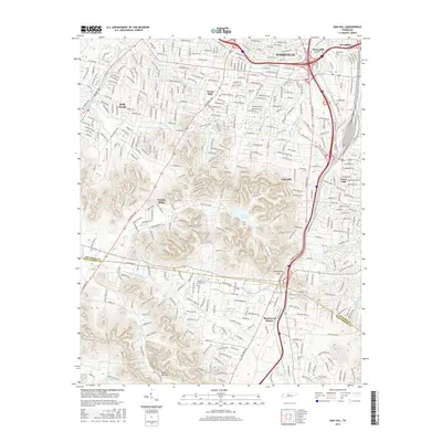
2016 Map of Oak Hill
USGS Topo · Published 2016About this map
The hills and valleys south of Nashville define a residential and institutional landscape where the city meets the Davidson and Williamson County line. Modern development centers around long-established communities like Belle Meade, Green Hills, and Berry Hill, while the higher elevations provide a backdrop for the waters of Radnor Lake. In the southern reaches, the Little Harpeth River winds through the suburban transition toward Brentwood Station, a historic point along the CSX Transportation railroad corridor. The area’s academic and commemorative history is well-marked, featuring the campus of Lipscomb University and large memorial grounds such as Woodlawn Cemetery. Topographical features like Atchinsons Gap and Reed Hollow highlight the drainage patterns that feed into the Richland Creek and East Fork Browns Creek systems, illustrating how the natural topography dictated the layout of major thoroughfares like Hillsboro Pike and Franklin Road.
Find a feature on this map
39 named features on this map. Tap any name to fly to it.
Don’t see what you’re looking for? This feature index may not catch every label — zoom into the map to look around manually.
Map Details
Editions of this 2016 Oak Hill Map
This is the sole edition of this map. No revisions or reprints were ever made.
Other maps of this area

1903 · Nashville
USGS Topo · 1:125,000

1909 · Franklin
USGS Topo · 1:62,500

1932 · Hermitage
USGS Topo · 1:62,500

1932 · Nashville
USGS Topo · 1:62,500

1942 · Lebanon
USGS Topo · 1:100,000

1946 · Leipers Fork
USGS Topo · 1:24,000

1949 · Leipers Fork
USGS Topo · 1:24,000

1949 · Franklin
USGS Topo · 1:24,000

1952 · Nashville West
USGS Topo · 1:24,000

1952 · Nashville East
USGS Topo · 1:24,000