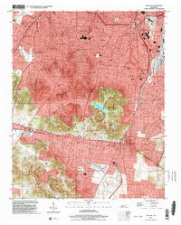
1997 Map of Oak Hill
USGS Topo · Published 2002About this map
Radnor Yards and the sprawling Woodlawn Cemetery anchor the eastern edge of this late 20th-century landscape, marking a transition from industrial rail infrastructure to the residential suburbs south of Nashville. The map documents a period of significant suburban expansion, where the municipal boundaries of Oak Hill, Forest Hills, and Berry Hill meet the northern edge of the Brentwood Corporate Boundary. This development is deeply intertwined with the region's topography, as seen in the protected acreage of the Radnor Lake State Natural Area and the high ground hosting the Vanderbilt University Observatory.
Find a feature on this map
49 named features on this map. Tap any name to fly to it.
Don’t see what you’re looking for? This feature index may not catch every label — zoom into the map to look around manually.
Map Details
Editions of this 1997 Oak Hill Map
This is the sole edition of this map. No revisions or reprints were ever made.
Other maps of this area

1903 · Nashville
USGS Topo · 1:125,000

1909 · Franklin
USGS Topo · 1:62,500

1932 · Hermitage
USGS Topo · 1:62,500

1932 · Nashville
USGS Topo · 1:62,500

1942 · Lebanon
USGS Topo · 1:100,000

1946 · Leipers Fork
USGS Topo · 1:24,000

1949 · Leipers Fork
USGS Topo · 1:24,000

1949 · Franklin
USGS Topo · 1:24,000

1952 · Nashville West
USGS Topo · 1:24,000

1952 · Nashville East
USGS Topo · 1:24,000