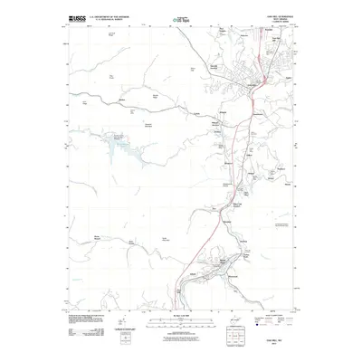
2011 Map of Oak Hill
USGS Topo · Published 2011About this map
Oak Hill and Mount Hope anchor this coal-country landscape in Fayette County, where the topography is defined by narrow ridges and winding creek valleys. The map documents a dense network of small communities and industrial junctions, including Whipple Junction, White Oak Junction, and Oak Hill Junction, which served the region's transport needs. Several post offices remain central to these dispersed settlements, from Scarbro and Hilltop to Glen Jean. The rugged elevation features include Haystack Mountain and Packs Mountain, while water management is highlighted by Plum Orchard Lake and the Fayette County Lake Number One Dam. For genealogists, the map locates several burial grounds such as High Lawn Memorial Park, Hilltop Cemetery, and Bays Cemetery, providing precise locations for family research in this historically significant West Virginia mining district.
Find a feature on this map
98 named features on this map. Tap any name to fly to it.
Don’t see what you’re looking for? This feature index may not catch every label — zoom into the map to look around manually.
Map Details
Editions of this 2011 Oak Hill Map
This is the sole edition of this map. No revisions or reprints were ever made.
Other maps of this area

1891 · Raleigh
USGS Topo · 1:125,000

1897 · Kanawha Falls
USGS Topo · 1:125,000

1897 · Raleigh
USGS Topo · 1:125,000

1900 · Kanawha Falls
USGS Topo · 1:125,000

1901 · Kanawha Falls
USGS Topo · 1:125,000

1902 · Raleigh
USGS Topo · 1:125,000

1908 · Fayetteville
USGS Topo · 1:48,000

1908 · Montgomery
USGS Topo · 1:48,000

1910 · Fayetteville
USGS Topo · 1:62,500

1910 · Montgomery
USGS Topo · 1:62,500