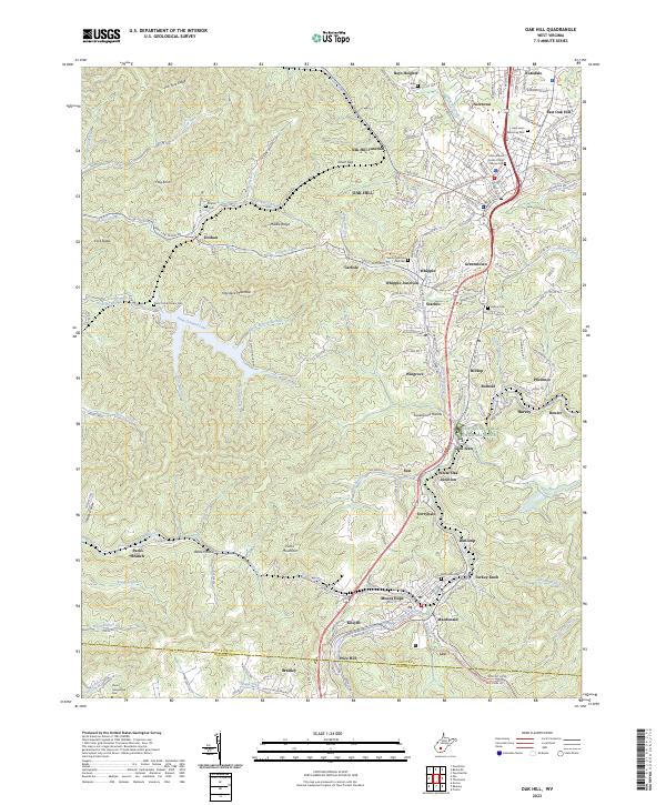
2023 Map of Oak Hill
USGS Topo · Published 2023About this map
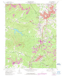
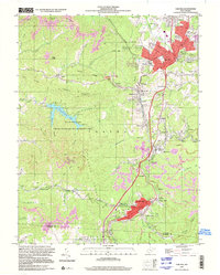
The coal country of Fayette County, West Virginia, is defined by the dense clustering of communities and rail history surrounding the Oak Hill and Mount Hope corridor. This survey captures a landscape of steep ridges and deep hollows where settlements like Scarbro, Whipple, and Glen Jean developed along the narrow valleys. The presence of the C & O RR and numerous junctions, including White Oak Junction and Whipple Junction, speaks to the industrial legacy of the region. Family and community history is preserved in localized sites such as the Davis Homestead Cem and the McDonald Cem. To the west, the terrain transitions into the protected environment of the New River Gorge National River and the recreational waters of Plum Orchard Lake. Modern transformations are visible in the conversion of old infrastructure, such as the Mount Hope Rail Trail, which repurposed former railway corridors for contemporary use.
Find a feature on this map
175 named features on this map. Tap any name to fly to it.
Don’t see what you’re looking for? This feature index may not catch every label — zoom into the map to look around manually.
Map Details
Editions of this 2023 Oak Hill Map
This is the sole edition of this map. No revisions or reprints were ever made.
Historical Maps of Macdonald Through Time
3 maps found