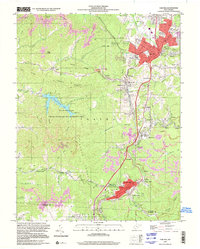
1997 Map of Oak Hill
USGS Topo · Published 2001About this map
Oak Hill and Mount Hope anchor this 1997 photo-revision of a Fayette County industrial landscape, where the coal-mining heritage of the New River Gorge region remains visible through features like the Tipple Mine Dump and numerous air shafts. The settlement pattern follows the narrow valley floors and ridgelines, with clusters at Glen Jean, Scarbro, and Minden connected by the CSX Transportation rail lines. Family and local history is preserved in sites like the High Lawn Mem Park and Odd Fellows Cem, alongside community landmarks such as Collins High Sch and White Oak Church. To the west, the Plum Orchard State Wildlife Management Area and the waters of Plum Orchard Lake offer a distinct shift from the dense urban and mining corridors, illustrating the complex geography of this Appalachian plateau.
Find a feature on this map
91 named features on this map. Tap any name to fly to it.
Don’t see what you’re looking for? This feature index may not catch every label — zoom into the map to look around manually.
Map Details
Editions of this 1997 Oak Hill Map
This is the sole edition of this map. No revisions or reprints were ever made.
Other maps of this area

1891 · Raleigh
USGS Topo · 1:125,000

1897 · Kanawha Falls
USGS Topo · 1:125,000

1897 · Raleigh
USGS Topo · 1:125,000

1900 · Kanawha Falls
USGS Topo · 1:125,000

1901 · Kanawha Falls
USGS Topo · 1:125,000

1902 · Raleigh
USGS Topo · 1:125,000

1908 · Fayetteville
USGS Topo · 1:48,000

1908 · Montgomery
USGS Topo · 1:48,000

1910 · Fayetteville
USGS Topo · 1:62,500

1910 · Montgomery
USGS Topo · 1:62,500