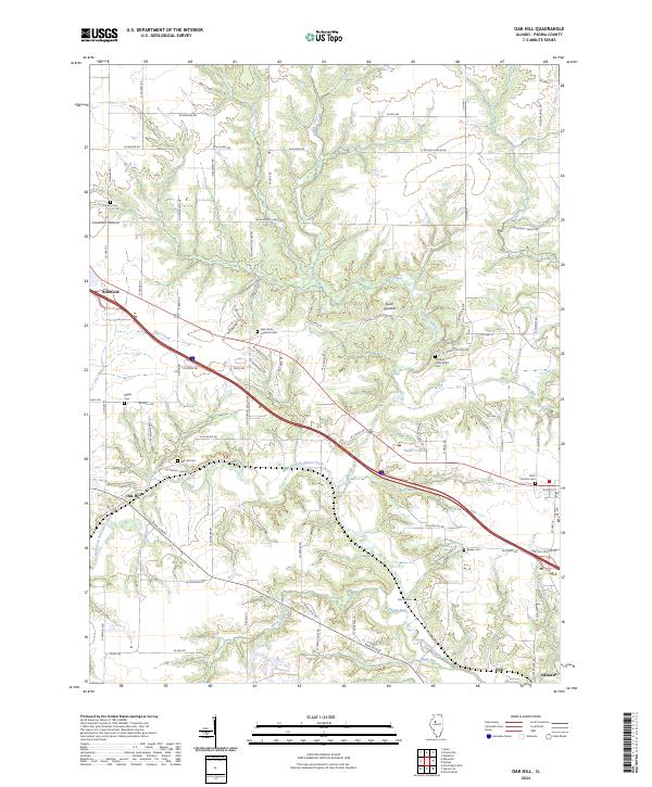
2024 Map of Oak Hill
USGS Topo · Published 2024About this map
Brimfield and the surrounding Peoria County countryside are detailed in this contemporary look at the Illinois prairie landscape. The region is defined by the winding course of Jubilee Creek and the West Fork Kickapoo Creek, which cut through the terrain to create the open spaces of Quail Meadow and the protected grounds of Jubilee College State Park. This modern survey is particularly valuable for genealogical research, as it documents numerous legacy burial sites including Oak Hill Cem, Jubilee Churchyard Cem, and Saint Patrick's Cem. Small settlements like Oak Hill and Edwards anchor the road network, which still follows many of the original section lines. From the banks of Tiber Creek to the community at Olin, the map preserves the names of the local landmarks that have shaped this rural corridor for generations.
Find a feature on this map
87 named features on this map. Tap any name to fly to it.
Don’t see what you’re looking for? This feature index may not catch every label — zoom into the map to look around manually.
Map Details
Editions of this 2024 Oak Hill Map
This is the sole edition of this map. No revisions or reprints were ever made.
Other maps of this area

1893 · Dunlap
USGS Topo · 1:62,500

1898 · Dunlap
USGS Topo · 1:62,500

1905 · Peoria
USGS Topo · 1:62,500

1927 · Peoria
USGS Topo · 1:62,500

1930 · Glasford
USGS Topo · 1:62,500

1932 · Dunlap
USGS Topo · 1:62,500

1933 · Dunlap
USGS Topo · 1:62,500

1937 · Dunlap
USGS Topo · 1:62,500

1944 · Elmwood
USGS Topo · 1:62,500

1948 · Elmwood
USGS Topo · 1:62,500