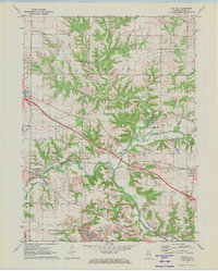
1971 Map of Oak Hill
USGS Topo · Published 1973About this map
The Jubilee College State Park landscape is defined by the winding course of Jubilee Creek and Kickapoo Creek in the early 1970s. This survey records the rural transition of Peoria County, showing the Burlington Northern rail line cutting through the villages of Oak Hill and Edwards. The map highlights a community anchored by tradition and civic preparedness, featuring several family and community burial grounds such as Lutheran Cem, Walker Cem, and Oak Hill Cem, alongside a Civil Defense Center and the Jubilee Lodge Home for Girls.
Find a feature on this map
41 named features on this map. Tap any name to fly to it.
Don’t see what you’re looking for? This feature index may not catch every label — zoom into the map to look around manually.
Map Details
Editions of this 1971 Oak Hill Map
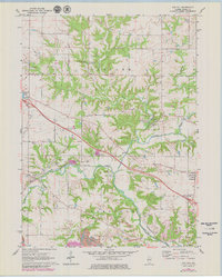
2 editions found
Other maps of this area

1893 · Dunlap
USGS Topo · 1:62,500

1898 · Dunlap
USGS Topo · 1:62,500

1905 · Peoria
USGS Topo · 1:62,500

1927 · Peoria
USGS Topo · 1:62,500

1930 · Glasford
USGS Topo · 1:62,500

1932 · Dunlap
USGS Topo · 1:62,500

1933 · Dunlap
USGS Topo · 1:62,500

1937 · Dunlap
USGS Topo · 1:62,500

1944 · Elmwood
USGS Topo · 1:62,500

1948 · Elmwood
USGS Topo · 1:62,500