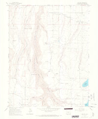
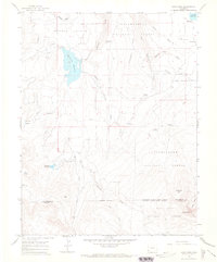
1964 Map of Oak Hill
USGS Topo · Published 1968About this map
Uncompahgre National Forest dominates this mid-century landscape in San Miguel County, where the topography is defined by deep drainages like Naturita Creek and McKee Draw. The presence of Williams Cabin and several namesake water features, such as Williams Res and Old City Reservoir, suggests a period of active high-altitude ranching and water management. Land use is clearly delineated between the wooded national forest and the open expanses of Greager Flats and Goshorn Flats to the south.
Find a feature on this map
41 named features on this map. Tap any name to fly to it.
Don’t see what you’re looking for? This feature index may not catch every label — zoom into the map to look around manually.
Map Details
Editions of this 1964 Oak Hill Map
4 editions found
Other maps of this area

1956 · Cortez
USGS Topo · 1:250,000

1956 · Moab
USGS Topo · 1:250,000

1958 · Cortez
USGS Topo · 1:250,000

1959 · Cortez
USGS Topo · 1:250,000

1959 · Moab
USGS Topo · 1:250,000

1960 · Moab
USGS Topo · 1:250,000

1962 · Moab
USGS Topo · 1:250,000

1962 · Cortez
USGS Topo · 1:250,000

1964 · Moab
USGS Topo · 1:250,000
1964 · Lone Cone
USGS Topo · 1:24,000