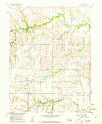
1960 Map of Oak
USGS Topo · Published 1961About this map
The Little Blue River winds through the northern portion of this Nebraska landscape, where the grain-milling industry is represented by the Oak Mill near the town of Oak. The terrain is defined by a dense network of drainages including Elk Creek, Oak Creek, and Spring Creek, which divide the townships of Blaine, Elk, and Spring Creek. Settlement patterns follow the corridor of the Chicago and North Western railroad, which links the villages of Nora and Ruskin. Genealogists will find the Nora Cem and Spring Creek Cem situated near their respective communities. Evidence of changing transportation infrastructure is visible in the Old Railroad Grade cutting across the southern sections, marking a decommissioned route that predates the 1960 field checks.
Find a feature on this map
19 named features on this map. Tap any name to fly to it.
Don’t see what you’re looking for? This feature index may not catch every label — zoom into the map to look around manually.
Map Details
Editions of this 1960 Oak Map
This is the sole edition of this map. No revisions or reprints were ever made.
Other maps of this area

1898 · Superior
USGS Topo · 1:125,000

1898 · Hebron
USGS Topo · 1:125,000

1955 · Lincoln
USGS Topo · 1:250,000

1955 · Grand Island
USGS Topo · 1:250,000

1957 · Lincoln
USGS Topo · 1:250,000

1957 · Grand Island
USGS Topo · 1:250,000

1958 · Grand Island
USGS Topo · 1:250,000

1958 · Lincoln
USGS Topo · 1:250,000

1960 · Byron
USGS Topo · 1:24,000

1960 · Edgar
USGS Topo · 1:24,000