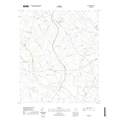
2020 Map of Oak Park
USGS Topo · Published 2020About this map
The town of Oak Park serves as a focal point in this portion of South Georgia, where the landscape is defined by the winding course of the Ohoopee River and its tributaries. The map reveals a dense network of family and community history, evidenced by numerous small burial grounds such as Morris Family Cem, Collins Cem, and the Shepherd Findley Cem. The area south of Oak Park is dominated by the hydrology of Reedy Cr and Little Reedy Cr, which thread through the terrain alongside established settlements like Normantown and the northern outskirts of Lyons. Transport and utility are highlighted by features such as Holt Airpark and Long Bridge, illustrating the modern infrastructure overlaid upon a traditional rural grid of roads like Racket Town RD and Harrington ST. The presence of the Toombs and Emanuel County line crossing the quadrangle further emphasizes the jurisdictional and geographic divisions of this coastal plain region.
Find a feature on this map
85 named features on this map. Tap any name to fly to it.
Don’t see what you’re looking for? This feature index may not catch every label — zoom into the map to look around manually.
Map Details
Editions of this 2020 Oak Park Map
This is the sole edition of this map. No revisions or reprints were ever made.
Other maps of this area

1957 · Macon
USGS Topo · 1:250,000

1958 · Macon
USGS Topo · 1:250,000

1964 · Macon
USGS Topo · 1:250,000

1970 · Cobbtown
USGS Topo · 1:24,000

1970 · Oak Park SW
USGS Topo · 1:24,000

1970 · Covena
USGS Topo · 1:24,000

1970 · Nunez
USGS Topo · 1:24,000

1970 · Vidalia
USGS Topo · 1:24,000

1970 · Ohoopee
USGS Topo · 1:24,000

1970 · Lyons
USGS Topo · 1:24,000