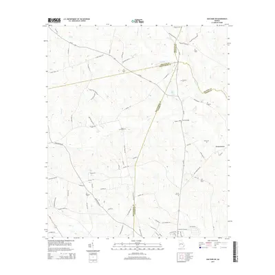
2014 Map of Oak Park SW
USGS Topo · Published 2014About this map
Normantown serves as a central hub in this section of South Georgia, where the boundaries of Toombs, Montgomery, Emanuel, and Treutlen counties converge. The landscape is defined by the drainages of Pendleton Cr and Tiger Cr, with local infrastructure like Holmes Bridge and Old Water Tank Rd marking the intersection of rural transit and water management. This 2014 survey documents a territory deeply marked by its local families, visible through a high concentration of small burial grounds and family plots.
Find a feature on this map
77 named features on this map. Tap any name to fly to it.
Don’t see what you’re looking for? This feature index may not catch every label — zoom into the map to look around manually.
Map Details
Editions of this 2014 Oak Park SW Map
This is the sole edition of this map. No revisions or reprints were ever made.
Other maps of this area

1957 · Macon
USGS Topo · 1:250,000

1958 · Macon
USGS Topo · 1:250,000

1964 · Macon
USGS Topo · 1:250,000

1970 · Oak Park SW
USGS Topo · 1:24,000

1970 · Covena
USGS Topo · 1:24,000

1970 · Mount Vernon
USGS Topo · 1:24,000

1970 · Nunez
USGS Topo · 1:24,000

1970 · Vidalia
USGS Topo · 1:24,000

1970 · Lyons
USGS Topo · 1:24,000

1970 · Oak Park
USGS Topo · 1:24,000