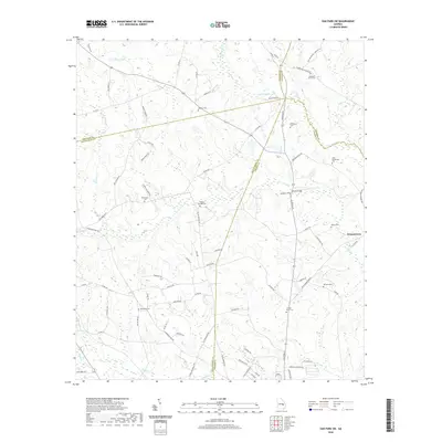
2020 Map of Oak Park SW
USGS Topo · Published 2020About this map
Pendleton Cr and its many tributaries, including Tiger Cr, Long Cr, and Mill Cr, carve a complex drainage pattern through this section of the Georgia coastal plain where four counties—Treutlen, Montgomery, Emanuel, and Toombs—converge. The settlement of Normantown sits on the eastern edge of the survey, surrounded by a landscape defined by small family-named cemeteries and agricultural roads. Genealogists may find particular value in the distribution of burial sites across the rural terrain, such as Margaret Morris Cem, Pidgeon Springs Cem, and the solitary McLeod Grave. The mapping of small water bodies like Rice Lake and Price Pond alongside crossings like Holmes Bridge illustrates the importance of local hydrology in dictating the road network, which includes numerous county routes and named lanes like Old Kibbee Rd S and Mosleytown Rd.
Find a feature on this map
82 named features on this map. Tap any name to fly to it.
Don’t see what you’re looking for? This feature index may not catch every label — zoom into the map to look around manually.
Map Details
Editions of this 2020 Oak Park SW Map
This is the sole edition of this map. No revisions or reprints were ever made.
Other maps of this area

1957 · Macon
USGS Topo · 1:250,000

1958 · Macon
USGS Topo · 1:250,000

1964 · Macon
USGS Topo · 1:250,000

1970 · Oak Park SW
USGS Topo · 1:24,000

1970 · Covena
USGS Topo · 1:24,000

1970 · Mount Vernon
USGS Topo · 1:24,000

1970 · Nunez
USGS Topo · 1:24,000

1970 · Vidalia
USGS Topo · 1:24,000

1970 · Lyons
USGS Topo · 1:24,000

1970 · Oak Park
USGS Topo · 1:24,000