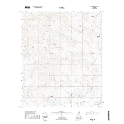
2020 Map of Oak Ridge
USGS Topo · Published 2020About this map
Oak Ridge and the surrounding Warren County landscape are defined by a high concentration of ancestral burial sites, indicating long-established family landholdings and rural communities. This survey reveals a terrain carved by numerous drainages, including Ballground Cr and Summer Seat Cr, where small settlements like Rawhide and Flowers developed along ridge roads. The map is a significant resource for genealogists, as it meticulously identifies family-named landmarks such as Brickhouse Cem, Lewis Cem, Parker Cem, and Hackler Cem. The intricate network of local routes, including Flowers Hill Rd and Dillon Ridge Rd, follows the natural contours of the land, illustrating how the geography dictated the settlement patterns of these upland Mississippi communities. The presence of the Warren Co Hinds Co boundary in the southeast corner further situates these rural hubs within their broader administrative context.
Find a feature on this map
58 named features on this map. Tap any name to fly to it.
Don’t see what you’re looking for? This feature index may not catch every label — zoom into the map to look around manually.
Map Details
Editions of this 2020 Oak Ridge Map
This is the sole edition of this map. No revisions or reprints were ever made.
Other maps of this area

1918 · Vicksburg
USGS Topo · 1:62,500

1938 · Edwards
USGS Topo · 1:62,500

1939 · Onward
USGS Topo · 1:62,500

1940 · Mechanicsburg
USGS Topo · 1:62,500

1941 · Vicksburg
USGS Topo · 1:62,500

1955 · Jackson
USGS Topo · 1:250,000

1961 · Jackson
USGS Topo · 1:250,000

1962 · Jackson
USGS Topo · 1:250,000

1962 · Redwood
USGS Topo · 1:24,000

1962 · Vicksburg East
USGS Topo · 1:24,000