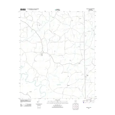
2012 Map of Oak Vale
USGS Topo · Published 2012About this map
Pearl River dominates the southwestern corner of this landscape, its winding course defining the boundary between bottomlands and the upland settlements of Marion County. The rural communities of Oak Vale and Society Hill serve as local anchors, connected by a network of family-named roads like W B Speights Rd and Johnny Wilson Rd. For those researching regional history or genealogy, the distribution of burial grounds such as Society Hill Cem and Hepzibah Cem offers a direct link to the families who settled this territory between the river and the various branches of Greens Cr. The geography transitions from the riparian environment of Cypress Cr to the higher ground near Hathorn, where agricultural fields and timberlands meet at the crossroads of the Mississippi piney woods.
Find a feature on this map
95 named features on this map. Tap any name to fly to it.
Don’t see what you’re looking for? This feature index may not catch every label — zoom into the map to look around manually.
Map Details
Editions of this 2012 Oak Vale Map
This is the sole edition of this map. No revisions or reprints were ever made.
Other maps of this area

1953 · Hattiesburg
USGS Topo · 1:250,000

1953 · Natchez
USGS Topo · 1:250,000

1956 · Natchez
USGS Topo · 1:250,000

1958 · Hattiesburg
USGS Topo · 1:250,000

1959 · Natchez
USGS Topo · 1:250,000

1970 · Prentiss West
USGS Topo · 1:24,000

1970 · Monticello
USGS Topo · 1:24,000

1970 · Bunker Hill
USGS Topo · 1:24,000

1970 · Darbun
USGS Topo · 1:24,000

1970 · Morgantown
USGS Topo · 1:24,000