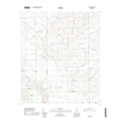
2020 Map of Oak Vale
USGS Topo · Published 2020About this map
The Pearl River winds through this rural landscape at the junction of Lawrence, Jefferson Davis, and Marion counties. Small settlements and family enclaves are scattered throughout the hills, including Oak Vale, Hathorn, and Society Hill. The area is notably dense with family and community burial sites, providing a significant record of local lineage through features like the Society Hill Cem, Ezekiel Loftin Cem, and Blackwell Cem. A complex network of local roads such as W Daniels Rd and Society Hill Rd connects these upland communities. The terrain is defined by the drainage of White Sand Creek and several forks of W Fork Greens Cr, which feed into the primary river valley. This map captures the modern distribution of these long-standing Mississippi communities as they appeared in 2020.
Find a feature on this map
77 named features on this map. Tap any name to fly to it.
Don’t see what you’re looking for? This feature index may not catch every label — zoom into the map to look around manually.
Map Details
Editions of this 2020 Oak Vale Map
This is the sole edition of this map. No revisions or reprints were ever made.
Other maps of this area

1953 · Hattiesburg
USGS Topo · 1:250,000

1953 · Natchez
USGS Topo · 1:250,000

1956 · Natchez
USGS Topo · 1:250,000

1958 · Hattiesburg
USGS Topo · 1:250,000

1959 · Natchez
USGS Topo · 1:250,000

1970 · Prentiss West
USGS Topo · 1:24,000

1970 · Monticello
USGS Topo · 1:24,000

1970 · Bunker Hill
USGS Topo · 1:24,000

1970 · Darbun
USGS Topo · 1:24,000

1970 · Morgantown
USGS Topo · 1:24,000