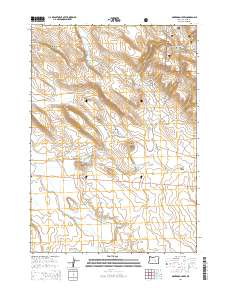
2014 Map of Oakerman Lakes
USGS Topo · Published 2014About this map
Oakerman Lakes and the surrounding high desert terrain define this landscape in Harney County, situated just south of the Ochoco National Forest boundary. The map reveals a sophisticated water management system for this arid region, featuring names like Zoglmann Reservoir, Upper Rock Quarry Canyon Reservoir, and the seasonal flow of Silver Creek. The presence of Maude Oakerman Spring and Oakerman Butte suggests the long-standing influence of the Oakerman family on the local geography. Human passage through this area is anchored by Us-20 and the gravel path of Riley Market Ln, while the natural drainage patterns of Gumboot Canyon and Rock Quarry Canyon carve through the sagebrush flats. This survey provides a precise look at the township and range boundaries that organized these remote ranchlands in the early 21st century.
Find a feature on this map
21 named features on this map. Tap any name to fly to it.
Don’t see what you’re looking for? This feature index may not catch every label — zoom into the map to look around manually.
Map Details
Editions of this 2014 Oakerman Lakes Map
This is the sole edition of this map. No revisions or reprints were ever made.
Other maps of this area

1955 · Burns
USGS Topo · 1:250,000

1958 · Burns
USGS Topo · 1:250,000

1959 · Burns
USGS Topo · 1:250,000
1979 · Moon Reservoir
USGS Topo · 1:24,000
1980 · Capehart Lake
USGS Topo · 1:24,000
1980 · Palomino Buttes
USGS Topo · 1:24,000
1981 · Sage Hen Hill
USGS Topo · 1:24,000
1981 · Egypt Canyon
USGS Topo · 1:24,000
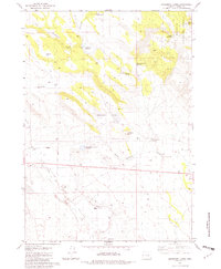
1981 · Oakerman Lakes
USGS Topo · 1:24,000
1981 · Holmes Canyon
USGS Topo · 1:24,000