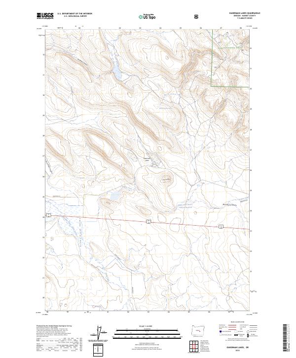
2023 Map of Oakerman Lakes
USGS Topo · Published 2023About this map
Ochoco National Forest borders the northeastern corner of this high-desert landscape, where the terrain transitions from the timbered heights of the Blue Mountains into the open expanses of the Silver Creek Valley. Water is the defining resource of this arid region, marked by seasonal drainages and local landmarks like Maude Oakerman Spring and the Oakerman Lakes. The drainage network is anchored by Silver Creek and Chickahominy Creek, which cut through the sagebrush flats below Oakerman Butte.
Find a feature on this map
23 named features on this map. Tap any name to fly to it.
Don’t see what you’re looking for? This feature index may not catch every label — zoom into the map to look around manually.
Map Details
Editions of this 2023 Oakerman Lakes Map
This is the sole edition of this map. No revisions or reprints were ever made.
Other maps of this area

1955 · Burns
USGS Topo · 1:250,000

1958 · Burns
USGS Topo · 1:250,000

1959 · Burns
USGS Topo · 1:250,000

1979 · Moon Reservoir
USGS Topo · 1:24,000

1980 · Capehart Lake
USGS Topo · 1:24,000

1980 · Palomino Buttes
USGS Topo · 1:24,000

1981 · Sage Hen Hill
USGS Topo · 1:24,000
1981 · Egypt Canyon
USGS Topo · 1:24,000
1981 · Oakerman Lakes
USGS Topo · 1:24,000
1981 · Holmes Canyon
USGS Topo · 1:24,000