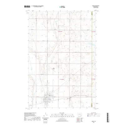
2017 Map of Oakes
USGS Topo · Published 2017About this map
Oakes sits at the heart of this landscape, its residential streets organized along fruit-named thoroughfares like Lilac Ave and Nectarine Ave. The town is bounded to the west by the winding path of the James River, while Bear Creek meanders through the northern rural sections. The township structure is strictly defined by a network of numbered section lines, including 81st St SE through 88th St SE, which grid the surrounding agricultural land. On the eastern edge of the community, local heritage is anchored at Saint Charles Cem and Oakes View Cem. The presence of the Oakes Municipal Airport to the north signifies the importance of regional connectivity for this Dickey County hub during the early twenty-first century.
Find a feature on this map
28 named features on this map. Tap any name to fly to it.
Don’t see what you’re looking for? This feature index may not catch every label — zoom into the map to look around manually.
Map Details
Editions of this 2017 Oakes Map
This is the sole edition of this map. No revisions or reprints were ever made.
Other maps of this area

1894 · Oakes
USGS Topo · 1:62,500

1895 · Lamoure
USGS Topo · 1:125,000

1918 · La Moure
USGS Topo · 1:125,000

1952 · Glover
USGS Topo · 1:24,000

1952 · Oakes
USGS Topo · 1:24,000

1952 · Crete
USGS Topo · 1:24,000

1952 · Independence
USGS Topo · 1:24,000

1953 · Jamestown
USGS Topo · 1:250,000

1953 · Fargo
USGS Topo · 1:250,000
1955 · Oakes SE
USGS Topo · 1:24,000