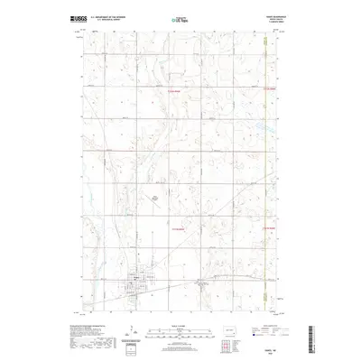
2020 Map of Oakes
USGS Topo · Published 2020About this map
The town of Oakes serves as the central hub of this North Dakota landscape, organized by a precise grid of rural section roads and residential streets like Oak Ave and Hickory Ave. Located in Dickey County, the settlement is positioned near the meandering course of the James River, which defines the western edge of the quadrangle. The surrounding prairie is drained by Bear Creek, a winding tributary that cuts through the agricultural sections to the north and east of the town center. Local history and genealogy are anchored by Saint Charles Cem and Oakes View Cem, located on the eastern outskirts near Dickey Co 3. Transportation is supported by the Oakes Municipal Airport, while the boundary between Dickey and Sargent counties is clearly marked along the eastern margin, reflecting the enduring township and range survey system that shaped this region.
Find a feature on this map
35 named features on this map. Tap any name to fly to it.
Don’t see what you’re looking for? This feature index may not catch every label — zoom into the map to look around manually.
Map Details
Editions of this 2020 Oakes Map
This is the sole edition of this map. No revisions or reprints were ever made.
Other maps of this area

1894 · Oakes
USGS Topo · 1:62,500

1895 · Lamoure
USGS Topo · 1:125,000

1918 · La Moure
USGS Topo · 1:125,000

1952 · Glover
USGS Topo · 1:24,000

1952 · Oakes
USGS Topo · 1:24,000

1952 · Crete
USGS Topo · 1:24,000

1952 · Independence
USGS Topo · 1:24,000

1953 · Jamestown
USGS Topo · 1:250,000

1953 · Fargo
USGS Topo · 1:250,000
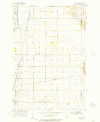
1955 · Oakes SE
USGS Topo · 1:24,000