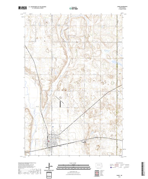
2024 Map of Oakes
USGS Topo · Published 2024About this map
Oakes serves as the primary hub in this southeastern North Dakota landscape, situated along the eastern bank of the James River. The town's grid is detailed with street names ranging from Oak Ave to Nectarine Ave, reflecting a settled community structure. To the east, the terrain is defined by the winding course of Bear Creek, which meanders through a network of wetlands and small water bodies. This 2024 survey documents the modern layout of the area, including the Oakes Municipal Airport and the transition across the Dickey Co and Sargent Co line. For those tracing local history or family lineage, the map provides precise locations for Saint Charles Cem and Oakes View Cem on the town's eastern outskirts, offering a clear record of these long-standing community landmarks.
Find a feature on this map
43 named features on this map. Tap any name to fly to it.
Don’t see what you’re looking for? This feature index may not catch every label — zoom into the map to look around manually.
Map Details
Editions of this 2024 Oakes Map
This is the sole edition of this map. No revisions or reprints were ever made.
Other maps of this area

1894 · Oakes
USGS Topo · 1:62,500

1895 · Lamoure
USGS Topo · 1:125,000

1918 · La Moure
USGS Topo · 1:125,000

1952 · Glover
USGS Topo · 1:24,000

1952 · Oakes
USGS Topo · 1:24,000

1952 · Crete
USGS Topo · 1:24,000

1952 · Independence
USGS Topo · 1:24,000

1953 · Jamestown
USGS Topo · 1:250,000

1953 · Fargo
USGS Topo · 1:250,000
1955 · Oakes SE
USGS Topo · 1:24,000