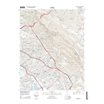
2015 Map of Oakland East
USGS Topo · Published 2015About this map
Oakland and its surrounding East Bay communities are shown here in the mid-2010s, illustrating the dense urban residential corridors that stretch from Berkeley down to Elmhurst. This survey highlights the complex infrastructure required to navigate the area's geography, from the Caldecott Tunnel and Claremont Tunnel cutting through the Berkeley Hills to the industrial waterworks of the Mokelumne Aqueduct. Educational and civic anchors are prominent, including Mills Coll and Merritt Coll, alongside the expansive green space of Redwood Regional Park.
Find a feature on this map
92 named features on this map. Tap any name to fly to it.
Don’t see what you’re looking for? This feature index may not catch every label — zoom into the map to look around manually.
Map Details
Editions of this 2015 Oakland East Map
This is the sole edition of this map. No revisions or reprints were ever made.
Other maps of this area

1892 · San Mateo
USGS Topo · 1:62,500

1895 · San Francisco
USGS Topo · 1:62,500

1896 · San Mateo
USGS Topo · 1:62,500

1897 · Concord
USGS Topo · 1:62,500

1899 · San Francisco
USGS Topo · 1:62,500

1899 · Haywards
USGS Topo · 1:62,500

1899 · San Mateo
USGS Topo · 1:62,500

1915 · San Mateo
USGS Topo · 1:62,500

1915 · Haywards
USGS Topo · 1:62,500

1915 · Concord
USGS Topo · 1:62,500