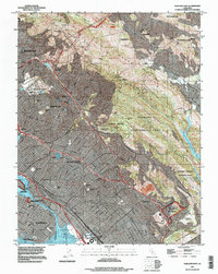
1997 Map of Oakland East
USGS Topo · Published 1997About this map
The Berkeley Hills form a dramatic backdrop for this dense urban landscape, which spans the eastern shores of Mud Bay and the Airport Channel. The map illustrates the intense development of the East Bay, where established neighborhoods in Oakland and Berkeley press against the steep elevations of the Laguna De Los Palos Colorados. Large institutional footprints are prominent, including the sprawling University of California campus and several historic educational centers like Mills College and Holy Names College. To the south, the industrial and military presence along the Tidal Canal is anchored by the Coast Guard Alameda Base.
Find a feature on this map
107 named features on this map. Tap any name to fly to it.
Don’t see what you’re looking for? This feature index may not catch every label — zoom into the map to look around manually.
Map Details
Editions of this 1997 Oakland East Map
This is the sole edition of this map. No revisions or reprints were ever made.
Other maps of this area

1892 · San Mateo
USGS Topo · 1:62,500

1895 · San Francisco
USGS Topo · 1:62,500

1896 · San Mateo
USGS Topo · 1:62,500

1897 · Concord
USGS Topo · 1:62,500

1899 · San Francisco
USGS Topo · 1:62,500

1899 · Haywards
USGS Topo · 1:62,500

1899 · San Mateo
USGS Topo · 1:62,500

1915 · San Mateo
USGS Topo · 1:62,500

1915 · Haywards
USGS Topo · 1:62,500

1915 · Concord
USGS Topo · 1:62,500