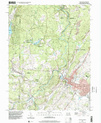
1997 Map of Oakland
USGS Topo · Published 2002About this map
The Youghiogheny River winds through the heart of this landscape, anchoring a region defined by its diverse state lands and the clustered settlements of Garrett County. High points such as Mt Nebo and Hoop Pole Ridge flank the river valley, while the communities of Oakland, Mountain Lake Park, and Loch Lynn Heights form a contiguous developed corridor in the southeast. This 1990s-era topography reveals a well-established infrastructure for both forestry and recreation, including Garrett State Forest and Swallow Falls State Park.
Find a feature on this map
60 named features on this map. Tap any name to fly to it.
Don’t see what you’re looking for? This feature index may not catch every label — zoom into the map to look around manually.
Map Details
Editions of this 1997 Oakland Map
This is the sole edition of this map. No revisions or reprints were ever made.
Other maps of this area

1886 · St. George
USGS Topo · 1:125,000

1891 · St. George
USGS Topo · 1:125,000

1895 · Piedmont
USGS Topo · 1:125,000

1899 · Oakland
USGS Topo · 1:62,500

1900 · Accident
USGS Topo · 1:62,500

1900 · Oakland
USGS Topo · 1:62,500

1904 · Bruceton
USGS Topo · 1:62,500

1907 · Kingwood
USGS Topo · 1:62,500

1925 · Kingwood
USGS Topo · 1:62,500

1926 · Bruceton
USGS Topo · 1:62,500