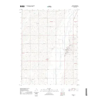
2018 Map of Oakland
USGS Topo · Published 2018About this map
Oakland serves as the focal point of this western Iowa landscape, situated along the banks of the West Nishnabotna River. The town's grid is clearly defined, featuring streets such as Chautauqua Ave, Palmer ST, and Walnut St, reflecting the community's development east of the waterway. Historically significant burial sites are well-documented across the township lines, including Oaklawn Cem near the town center, Big Grove Cem to the northwest, and Belknap Cem further south. The surrounding terrain is characterized by a network of drainage creeks, including Silver Cr, Slocum Cr, and Mud Cr, which dictate the placement of rural section roads like Lombardy Rd and Dogwood Rd. Local aviation is represented by Ridge Airport and Volkens Field, small facilities that underline the rural transportation infrastructure of Pottawattamie County during this period.
Find a feature on this map
52 named features on this map. Tap any name to fly to it.
Don’t see what you’re looking for? This feature index may not catch every label — zoom into the map to look around manually.
Map Details
Editions of this 2018 Oakland Map
This is the sole edition of this map. No revisions or reprints were ever made.
Other maps of this area

1954 · Omaha
USGS Topo · 1:250,000

1956 · Neola
USGS Topo · 1:24,000

1956 · Treynor
USGS Topo · 1:24,000

1957 · Omaha
USGS Topo · 1:250,000

1957 · Taylor
USGS Topo · 1:24,000

1958 · Omaha
USGS Topo · 1:250,000

1963 · Avoca NW
USGS Topo · 1:24,000

1963 · Avoca SE
USGS Topo · 1:24,000

1963 · Oakland
USGS Topo · 1:24,000

1963 · Avoca
USGS Topo · 1:24,000