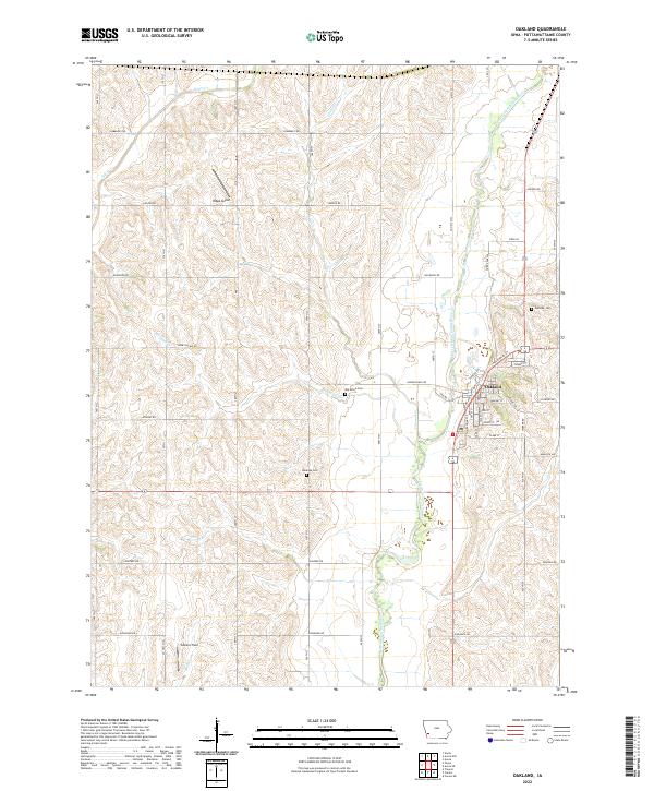
2022 Map of Oakland
USGS Topo · Published 2022About this map
The West Nishnabotna River meanders south through this section of Pottawattamie County, anchoring the town of Oakland. The settlement is defined by its grid of streets such as Chautauqua Ave, Main St, and Palmer ST, situated at a bend in the river valley. The surrounding agricultural landscape is etched by a drainage network including Silver Cr, Slocum Cr, and Minimum Cr, which feed into the primary river system. Local aviation is represented by Ridge Airport and Volkens Field, while several rural burial grounds, such as Oaklawn Cem, Big Grove Cem, and Belknap Cem, mark the cultural history of the townships. This 2022 survey captures the contemporary layout of section-line roads like Lombardy Rd and Hickory Rd that crisscross the undulating terrain between the river bottom and the higher ridges.
Find a feature on this map
50 named features on this map. Tap any name to fly to it.
Don’t see what you’re looking for? This feature index may not catch every label — zoom into the map to look around manually.
Map Details
Editions of this 2022 Oakland Map
This is the sole edition of this map. No revisions or reprints were ever made.