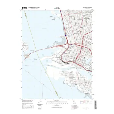
2015 Map of Oakland West
USGS Topo · Published 2015About this map
Oakland and its surrounding East Bay neighbors appear here in a densely populated urban landscape defined by maritime infrastructure and academic centers. The waterfront is a complex of transport corridors, from the San Francisco-Oakland Bay Bridge and the Rapid Transit Trans-Bay Tube to the ferry routes like the Alameda-Oakland Fry crossing the San Francisco Bay. Inland, the map reveals the distinct neighborhood character of places like Chinatown, Rochedale Village, and South Berkeley, while the Univ of California at Berkeley anchors the northern portion of the sheet.
Find a feature on this map
48 named features on this map. Tap any name to fly to it.
Don’t see what you’re looking for? This feature index may not catch every label — zoom into the map to look around manually.
Map Details
Editions of this 2015 Oakland West Map
This is the sole edition of this map. No revisions or reprints were ever made.
Other maps of this area

1892 · San Mateo
USGS Topo · 1:62,500

1895 · San Francisco
USGS Topo · 1:62,500

1896 · San Mateo
USGS Topo · 1:62,500

1897 · Concord
USGS Topo · 1:62,500

1899 · San Francisco
USGS Topo · 1:62,500

1899 · Haywards
USGS Topo · 1:62,500

1899 · San Mateo
USGS Topo · 1:62,500

1915 · San Mateo
USGS Topo · 1:62,500

1915 · Haywards
USGS Topo · 1:62,500

1915 · Concord
USGS Topo · 1:62,500