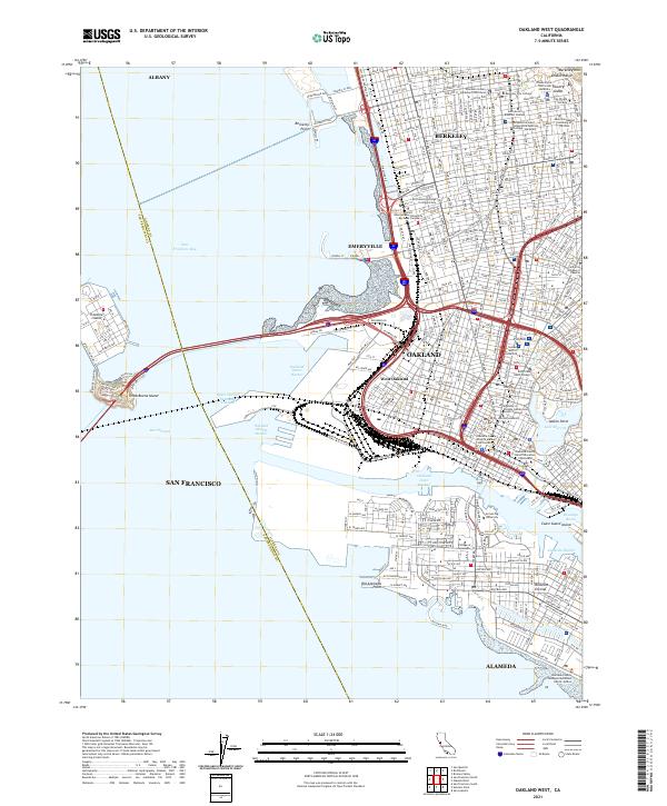
2021 Map of Oakland West
USGS Topo · Published 2021About this map
University of California - Berkeley dominates the northeastern corner of this coastal survey, where the Berkeley Hills meet the densely urbanized East Bay. The landscape is defined by the complex industrial and maritime infrastructure of the Oakland Outer Harbor and Oakland Middle Harbor, which separate the mainland from the artificial expanse of Treasure Island and the natural landmark of Yerba Buena Island. Dense neighborhood clusters such as Pill Hill, Adams Point, and West Oakland reveal the intricate street grids that knit these cities together.
Find a feature on this map
72 named features on this map. Tap any name to fly to it.
Don’t see what you’re looking for? This feature index may not catch every label — zoom into the map to look around manually.
Map Details
Editions of this 2021 Oakland West Map
This is the sole edition of this map. No revisions or reprints were ever made.
Other maps of this area

1892 · San Mateo
USGS Topo · 1:62,500

1895 · San Francisco
USGS Topo · 1:62,500

1896 · San Mateo
USGS Topo · 1:62,500

1897 · Concord
USGS Topo · 1:62,500

1899 · San Francisco
USGS Topo · 1:62,500

1899 · Haywards
USGS Topo · 1:62,500

1899 · San Mateo
USGS Topo · 1:62,500

1915 · San Mateo
USGS Topo · 1:62,500

1915 · Haywards
USGS Topo · 1:62,500

1915 · Concord
USGS Topo · 1:62,500