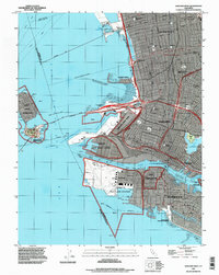
1993 Map of Oakland West
USGS Topo · Published 1997About this map
The massive military installations along the East Bay shoreline dominate this survey, which captures the industrial and maritime landscape of the mid-1990s. Heavy infrastructure for the Naval Supply Center, the sprawling Alameda Naval Air Station, and the Oakland Army Base anchor the waterfront, illustrating the scale of naval operations before several of these facilities underwent major transition. The San Francisco-Oakland Bay Bridge spans the water to reach Yerba Buena Island and the adjacent Treasure Island, forming a vital link between the urban centers.
Find a feature on this map
49 named features on this map. Tap any name to fly to it.
Don’t see what you’re looking for? This feature index may not catch every label — zoom into the map to look around manually.
Map Details
Editions of this 1993 Oakland West Map
This is the sole edition of this map. No revisions or reprints were ever made.
Other maps of this area

1892 · San Mateo
USGS Topo · 1:62,500

1895 · San Francisco
USGS Topo · 1:62,500

1896 · San Mateo
USGS Topo · 1:62,500

1897 · Concord
USGS Topo · 1:62,500

1899 · San Francisco
USGS Topo · 1:62,500

1899 · Haywards
USGS Topo · 1:62,500

1899 · San Mateo
USGS Topo · 1:62,500

1915 · San Mateo
USGS Topo · 1:62,500

1915 · Haywards
USGS Topo · 1:62,500

1915 · Concord
USGS Topo · 1:62,500