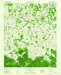
1960 Map of Oakville
USGS Topo · Published 1961About this map
Indian mound and the Oakville Spring anchor a landscape of deep historical roots in this part of Lawrence County. The northern half of the quadrangle is defined by rural farming communities such as Fairfield and Speake, where a dense network of country churches like Berea Ch and family cemeteries such as Dement Cem and Hodges Cem suggest a long-established agricultural population. A notable modern addition is the Drag strip located near Aldridge Grove, contrasting with the more traditional landmarks of the era.
Find a feature on this map
85 named features on this map. Tap any name to fly to it.
Don’t see what you’re looking for? This feature index may not catch every label — zoom into the map to look around manually.
Map Details
Editions of this 1960 Oakville Map
3 editions found
Other maps of this area

1935 · Moulton
USGS Topo · 1:24,000

1935 · Upshaw
USGS Topo · 1:24,000

1935 · Danville
USGS Topo · 1:48,000

1935 · Oakville
USGS Topo · 1:24,000

1936 · Caddo
USGS Topo · 1:24,000

1936 · Mc Kendry
USGS Topo · 1:24,000

1936 · Trinity
USGS Topo · 1:24,000

1936 · Moulton
USGS Topo · 1:48,000

1936 · Masterson
USGS Topo · 1:24,000

1936 · Stroups Crossroads
USGS Topo · 1:24,000