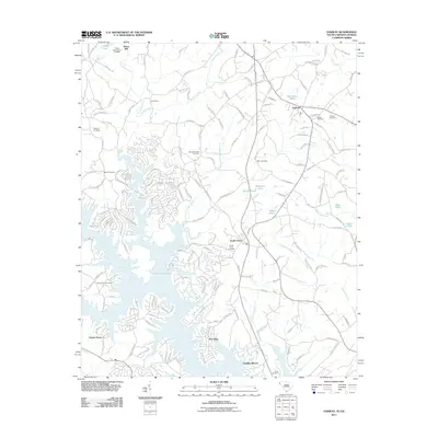
2011 Map of Oakway
USGS Topo · Published 2011About this map
The waters of Hartwell Lake dominate the southern landscape, creating a complex system of coves and peninsulas that have shaped local settlement. Along these shores, newer developments like Port Bass, Poplar Grove, and Fairplay Shores sit in contrast to older established crossroads. Further north, the agricultural and rural character remains prominent, centered around Oakway and South Union. The map provides a detailed view of the area's social history through its numerous burial grounds, including Nazareth Cemetery, Oakway Cemetery, and South Union Cemetery, which often serve as the primary markers for community heritage in the region.
Find a feature on this map
168 named features on this map. Tap any name to fly to it.
Don’t see what you’re looking for? This feature index may not catch every label — zoom into the map to look around manually.
Map Details
Editions of this 2011 Oakway Map
This is the sole edition of this map. No revisions or reprints were ever made.
Other maps of this area

1886 · Walhalla
USGS Topo · 1:125,000

1888 · Pickens
USGS Topo · 1:125,000

1891 · Carnesville
USGS Topo · 1:125,000

1892 · Walhalla
USGS Topo · 1:125,000

1893 · Elberton
USGS Topo · 1:125,000

1894 · Pickens
USGS Topo · 1:125,000

1896 · Walhalla
USGS Topo · 1:125,000

1954 · Greenville
USGS Topo · 1:250,000

1958 · Greenville
USGS Topo · 1:250,000

1958 · Seneca
USGS Topo · 1:24,000