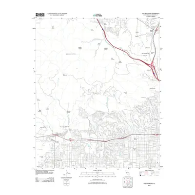
2012 Map of Oat Mountain
USGS Topo · Published 2012About this map
Chatsworth and Granada Hills anchor the southern base of the Santa Susana Mountains on this 2012 map, where suburban street grids meet the steep canyons of the transverse ranges. This interface is marked by significant cultural and topographical landmarks, such as the prominent sandstone formations of Stony Point and the nearby Garden of the Gods. To the north, the map documents the complex geography of the San Fernando Pass and Fremont Pass, critical transportation corridors shared by the Sierra Hwy and numerous tunnels.
Find a feature on this map
205 named features on this map. Tap any name to fly to it.
Don’t see what you’re looking for? This feature index may not catch every label — zoom into the map to look around manually.
Map Details
Editions of this 2012 Oat Mountain Map
This is the sole edition of this map. No revisions or reprints were ever made.
Other maps of this area

1894 · Los Angeles
USGS Topo · 1:62,500

1896 · Santa Monica
USGS Topo · 1:62,500

1898 · Santa Monica
USGS Topo · 1:62,500

1900 · Los Angeles
USGS Topo · 1:62,500

1900 · Fernando
USGS Topo · 1:62,500

1901 · Southern California Sheet No. 1
USGS Topo · 1:250,000

1902 · Santa Monica
USGS Topo · 1:62,500

1903 · Calabasas
USGS Topo · 1:62,500

1903 · Camulos
USGS Topo · 1:125,000

1903 · Santa Susana
USGS Topo · 1:62,500
Featured Places
- Los Angeles, CA
- Santa Clarita, CA
- Deer Lake Highlands, Unincorporated Chatsworth
- Unincorporated Chatsworth, CA
- Twin Lakes, Unincorporated Chatsworth