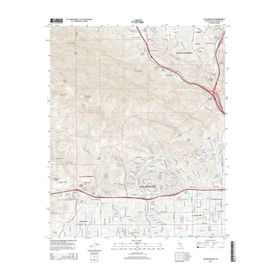
2015 Map of Oat Mountain
USGS Topo · Published 2015About this map
Santa Clarita and the northern edge of the Los Angeles basin meet in this topographic study of the Santa Susana Mountains. The terrain is defined by a complex network of canyons, including Towsley Canyon, Rice Canyon, and Sulphur Canyon, which historically served as critical transit corridors. Engineering feats are prominent here, with the Newhall Tunnel, Pacific Tunnel, and Santa Susana Tunnel marking the heavy investment in rail infrastructure required to penetrate the mountain barriers. In the southern half, the transition from wild terrain to suburban expansion is visible in neighborhoods like Granada Hills and Chatsworth, where the grid of streets like Rinaldi St and Devonshire St terminates abruptly against the rising slopes. Named landmarks such as Stony Point and Fern Ann Falls highlight the geological character of the region before it descends into the San Fernando Valley.
Find a feature on this map
75 named features on this map. Tap any name to fly to it.
Don’t see what you’re looking for? This feature index may not catch every label — zoom into the map to look around manually.
Map Details
Editions of this 2015 Oat Mountain Map
This is the sole edition of this map. No revisions or reprints were ever made.
Other maps of this area

1894 · Los Angeles
USGS Topo · 1:62,500

1896 · Santa Monica
USGS Topo · 1:62,500

1898 · Santa Monica
USGS Topo · 1:62,500

1900 · Los Angeles
USGS Topo · 1:62,500

1900 · Fernando
USGS Topo · 1:62,500

1901 · Southern California Sheet No. 1
USGS Topo · 1:250,000

1902 · Santa Monica
USGS Topo · 1:62,500

1903 · Calabasas
USGS Topo · 1:62,500

1903 · Camulos
USGS Topo · 1:125,000

1903 · Santa Susana
USGS Topo · 1:62,500
Featured Places
- Los Angeles, CA
- Santa Clarita, CA
- Deer Lake Highlands, Unincorporated Chatsworth
- Unincorporated Chatsworth, CA
- Twin Lakes, Unincorporated Chatsworth