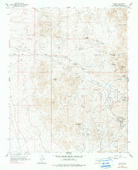
1967 Map of Oatman
USGS Topo · Published 1990About this map
Oatman and its surrounding gold-bearing districts appear in this mid-century survey, revealing a landscape deeply marked by Mohave County’s mineral history. The settlement sits at the heart of an intensive mining network, with the Tom Reed Mine and United Eastern Mine anchoring the local economy. To the north, the Goldroad Mine and the site of Old Trails indicate the shift from active production to historical remains along the ancient routes through the Black Mountains.
Find a feature on this map
39 named features on this map. Tap any name to fly to it.
Don’t see what you’re looking for? This feature index may not catch every label — zoom into the map to look around manually.
Map Details
Editions of this 1967 Oatman Map
4 editions found
Other maps of this area

1886 · Camp Mohave
USGS Topo · 1:250,000

1892 · Camp Mohave
USGS Topo · 1:250,000

1903 · Needles
USGS Topo · 1:125,000

1904 · Needles Special
USGS Topo · 1:125,000

1926 · Mohave City
USGS Topo · 1:96,000

1942 · Camp Mohave
USGS Topo · 1:250,000

1947 · Kingman
USGS Topo · 1:250,000

1948 · Kingman
USGS Topo · 1:250,000

1950 · Davis Dam
USGS Topo · 1:62,500

1950 · Needles
USGS Topo · 1:62,500