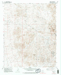
1967 Map of Oatman
USGS Topo · Published 1995About this map
Oatman and its surrounding gold mining district are the focal point of this late 1960s survey, showing a landscape defined by industrial extraction and high-desert topography. The settlement pattern reveals the legacy of the local mining boom, with the active community of Oatman contrasted by the Old Trails (Site) and Goldroad (Site), marking where earlier hubs once stood. The density of mining activity is striking, with the Goldroad Mine, Tom Reed Mine, and Moss Mine illustrating the intensive development of the Black Mountains.
Find a feature on this map
34 named features on this map. Tap any name to fly to it.
Don’t see what you’re looking for? This feature index may not catch every label — zoom into the map to look around manually.
Map Details
Editions of this 1967 Oatman Map
4 editions found
Other maps of this area

1886 · Camp Mohave
USGS Topo · 1:250,000

1892 · Camp Mohave
USGS Topo · 1:250,000

1903 · Needles
USGS Topo · 1:125,000

1904 · Needles Special
USGS Topo · 1:125,000

1926 · Mohave City
USGS Topo · 1:96,000

1942 · Camp Mohave
USGS Topo · 1:250,000

1947 · Kingman
USGS Topo · 1:250,000

1948 · Kingman
USGS Topo · 1:250,000

1950 · Davis Dam
USGS Topo · 1:62,500

1950 · Needles
USGS Topo · 1:62,500